

A charming little house in an out-of-the-way alley on the South Side.

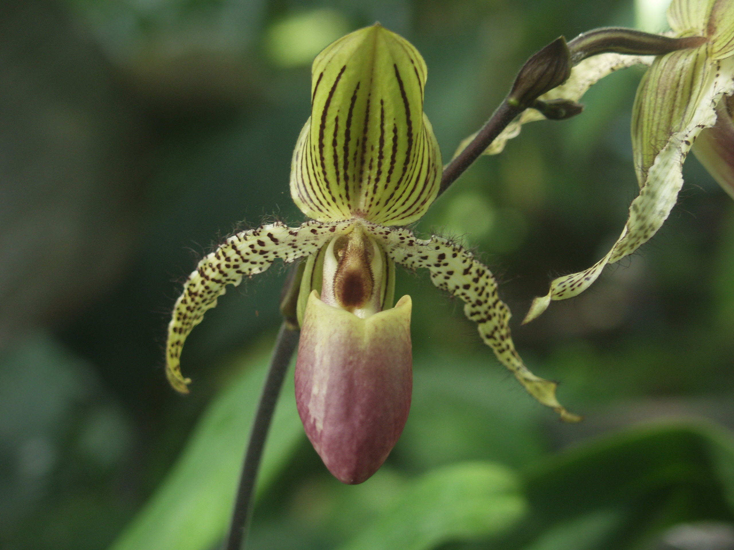
Its parents come from Indonesia, but this paph speaks with a Picksburgh accent. According to its tag in the Orchid Room at Phipps Conservatory, it has won an Award of Merit from the American Orchid Society.
Papihopedilum Transvaal is an old hybrid, first made in 1901, between P. chamberlainianum and P. rothschildianum. Orchid genetics are complex enough that the seedlings from a hybrid are all different, so each one can become a named clone (with the name in single quotes) if someone likes it well enough. Obviously, with AM-AOS after its name, someone would like this one a great deal.


These two matching apartment buildings on Craig Street were built between 1903 and 1910; although they seem to be known only by their numbers today, on our 1923 map they are marked as “Beverly” and “Bayard.” They once stood at the end of a row of similarly sized apartment buildings, but the others have been replaced by bigger apartment blocks. Those bays must make the front apartments very bright and cheerful on a sunny afternoon.

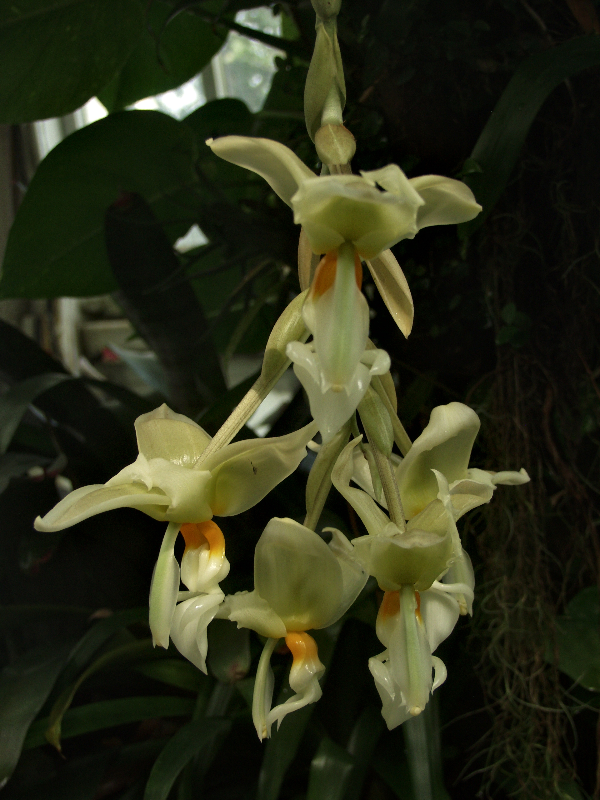
Stanhopea is a genus of orchids with remarkably complex flowers whose intricate mechanics make the pollinator bees go through an amusement-park ride to get the nectar they want, and incidentally pollinate the flower. The flowers hang down from the bottom of the plant, so in conservatories Stanhopea species are usually grown in hanging baskets. Above: Stanhopea ruckeri.
[Updated update: The tag identified the plant as Stanhopea wardii, but a Wikimedia Commons user identified the photos above as S. ruckeri and renamed the files, which made the pictures disappear from this page. They have been restored under their new file names. The user who changed them was kind enough to correspond with Father Pitt, noting that he had submitted the pictures to a leading orchid taxonomist who is an expert on Stanhopea. Phipps orchid tags are sometimes wrong, since the collection is huge and has been growing since 1892, so old Pa Pitt is inclined to believe the Stanhopea expert. But you should know, if you care, that there is some doubt.]
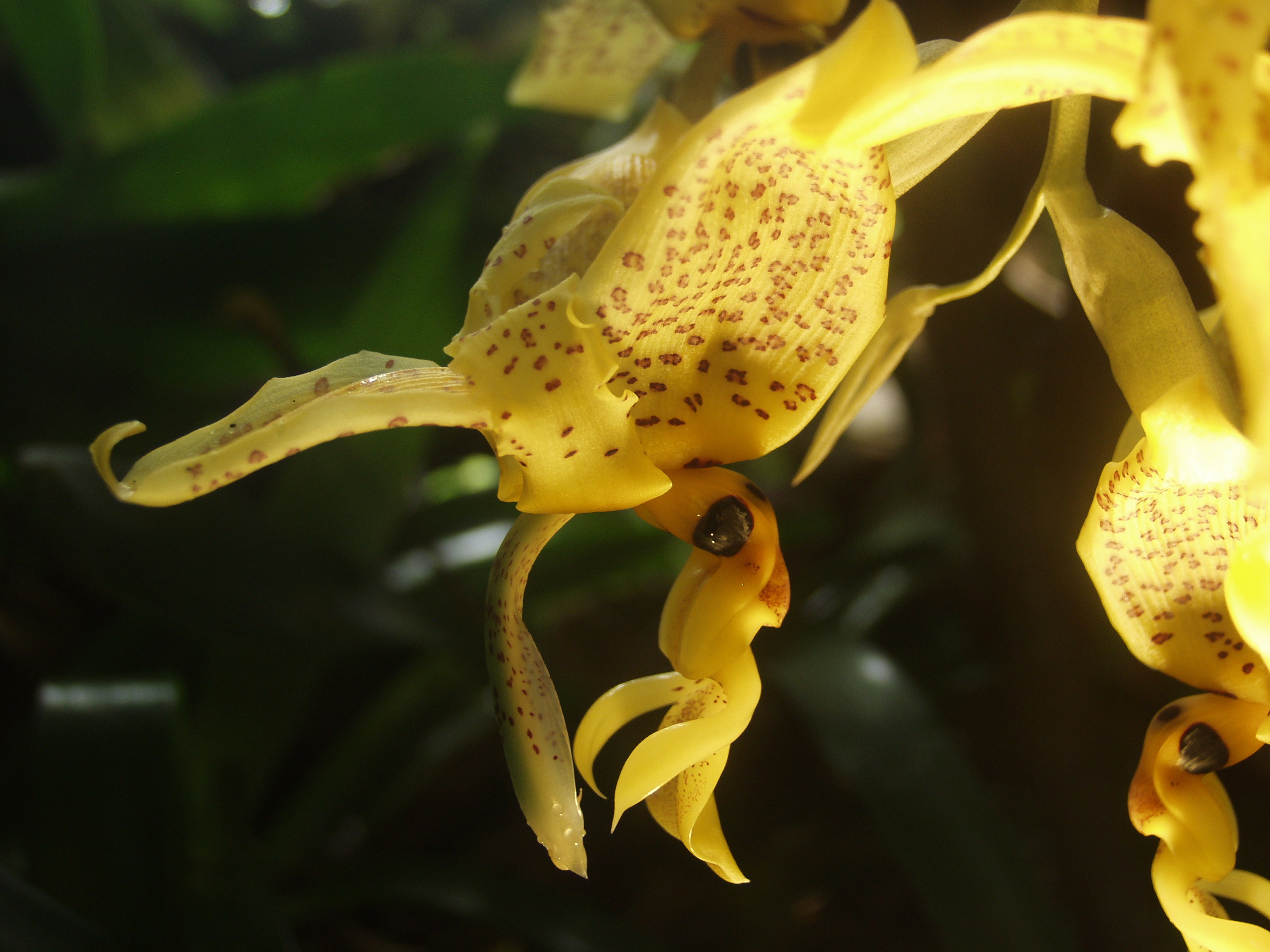
Below: an unidentified species of Stanhopea (marked “Stanhopea species” on the tag).

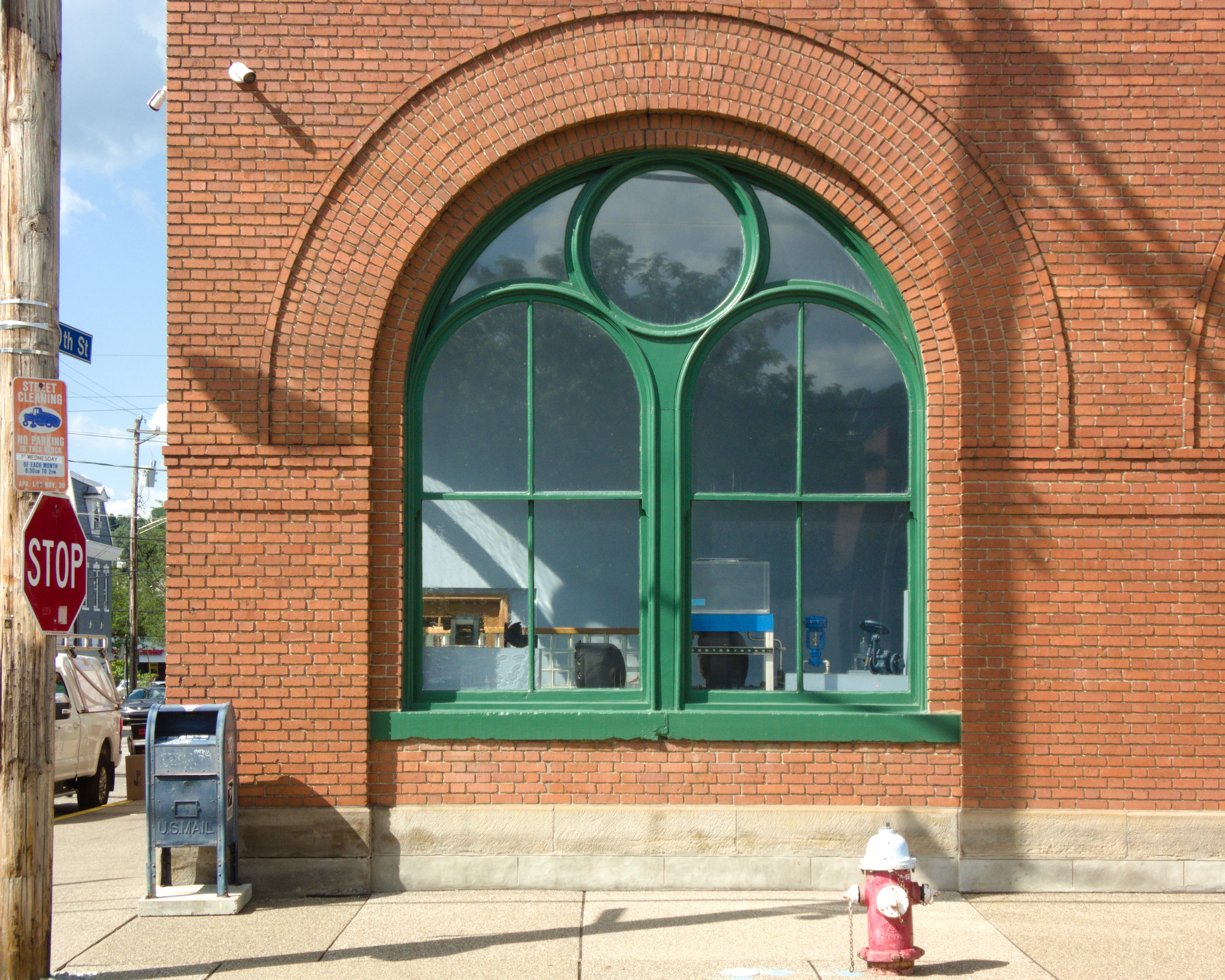
The double arch inside a single arch, with a circle to fill in the gap, is characteristic of the style of classically influenced Romanesque the Germans called Rundbogenstil, the round-arch style. It may not be exclusive to the Rundbogenstil, but Father Pitt likes to say the word “Rundbogenstil.” The B. M. Kramer and Co. building on the South Side, built as a beer warehouse, is one of the masterpieces of industrial architecture in Pittsburgh.
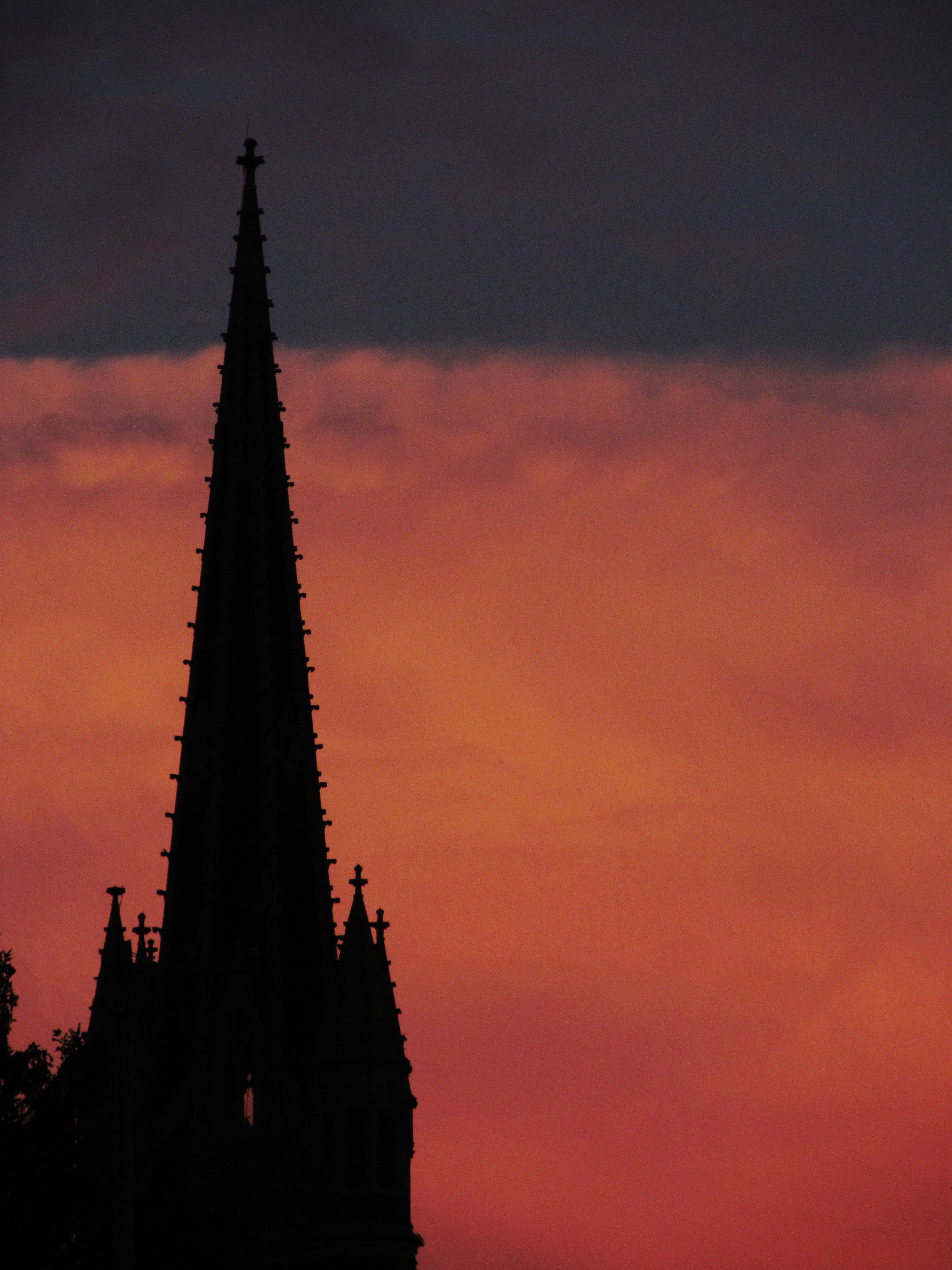
The spire of Third Presbyterian Church, Shadyside, silhouetted against retreating storm clouds at sunset.

Architecturally this house is a bit of a mess, but a pleasing mess. It was built in three different stages, the first in 1870 and the last in 1900.

The Thaw family was a bit of a mess, too. William Thaw was a railroad baron who made all the money in the world and had ten surviving children by two wives. Of those children, the one everybody remembers was Harry Thaw, who murdered Stanford White in front of as many witnesses as could possibly be crammed into one nightclub. It was the climax of a career of difficult situations, and in every one of them Harry’s mother used the mighty power of money to extract him from his difficulties. (Harry used money to light cigars with.) You can read about his murder of White and the legal adventures that followed in Harry Thaw’s Wikipedia article; for our purposes it is sufficient to say that the family money saved his hide again, and Clarence Darrow provided him with a nifty new defense called “temporary insanity.” Many who knew Harry Thaw would question the temporariness of the insanity.

This was not the Thaws’ biggest house. Their favorite architect, Theophilus P. Chandler Jr., designed a house for them in Squirrel Hill named Lyndhurst; that one was demolished in the 1940s.

Aluminum, vinyl, Insulbrick, and Perma-Stone: old Pa Pitt calls them the Four Horsemen of the Apocalypse. They are the four most common artificial sidings applied to Pittsburgh houses, especially frame houses. (But not exclusively frame houses: siding salesmen were aggressive enough to go for brick houses if they sensed weakness in the buyer.) They are responsible for more uglification in the city than any other single force. That is not to say that it is impossible to use them well, only that they are almost never used well. We can find perfect illustrations within a block of each other on the South Side.

Aluminum is usually easy to recognize by the rust stains, which probably come from the fasteners rather than the aluminum itself.

Vinyl siding is the closest in appearance to wood siding, and if applied well can be hard to distinguish from a distance. But instead of removing the wood siding and replacing it with vinyl, the contractors usually stick the vinyl over the wood siding. That means two bad things: first, that there is an invisible layer of decaying wood; second, that all the trim on the house is swallowed up, leaving the house a cartoon shell. In the picture above, the whole process has been taken to its logical conclusion in the right-hand house. A good deal of money was spent on new windows in the wrongest possible shapes, vinyl trim, and paste-on fake shutters that could not possibly cover the windows, leaving the house an expensive architectural wreck.
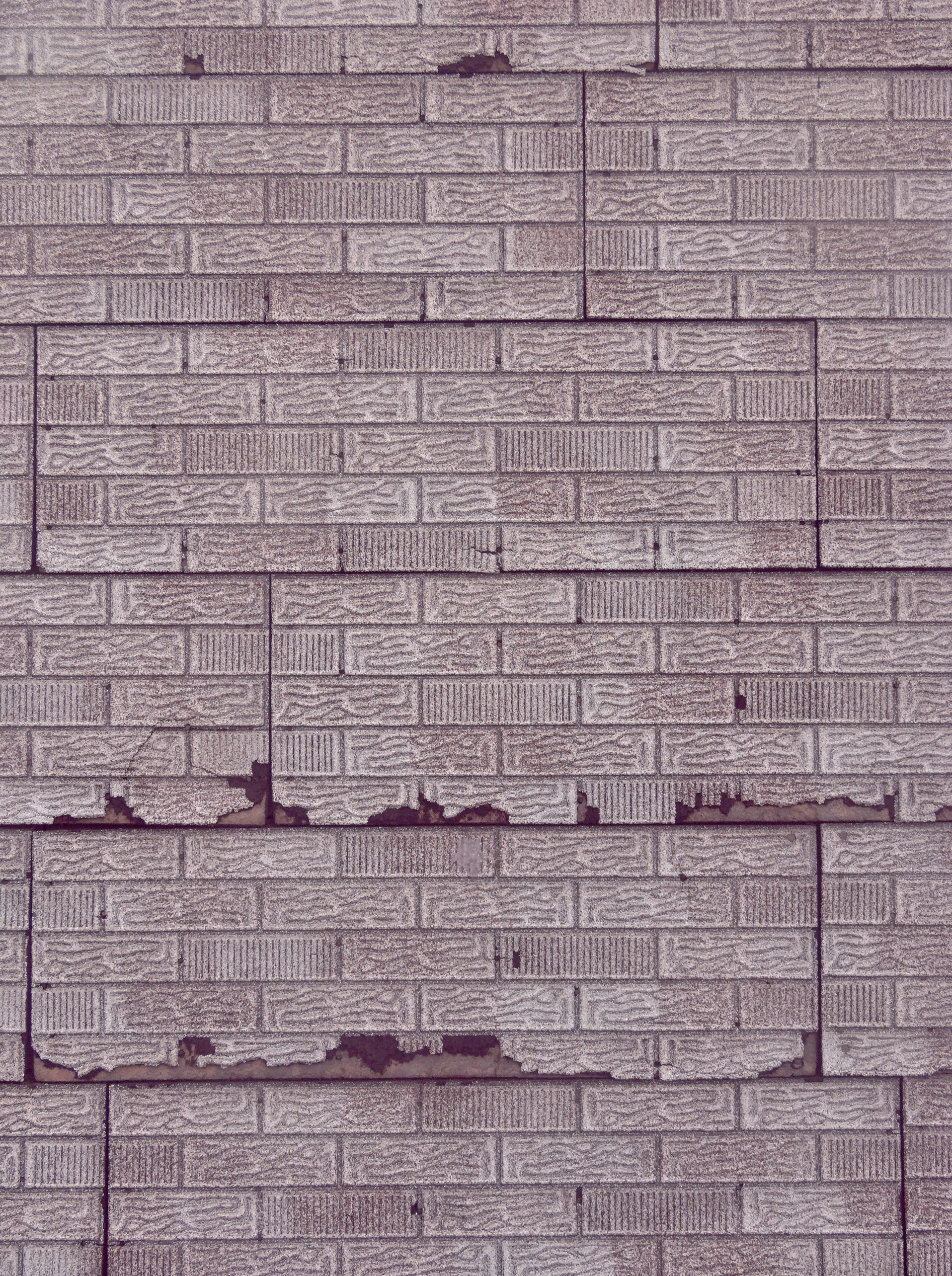
Insulbrick is a trademark name (though there were disputes over the trademark) for siding made up of asphalt sheets stamped with a brick pattern. When the siding is new, it looks as if a child drew bricks on the house with crayons. When it is older, it looks like the picture above. In spite of the name, it is very bad at insulating.

Perma-Stone is another trademark name: it is siding that imitates stonework, once again in a cartoonish fashion.
Sometimes more than one of these sidings can grow on a house, either because the owner loved variety, or because different generations attacked different maintenance problems in different halfhearted ways.

Insulbrick and vinyl.

Aluminum and Perma-Stone.
If you are the owner of a frame house that still has wooden siding, congratulations! You are a member of a small elite minority in Pittsburgh. Keep a good coat of paint on that siding, and attack problems while they are still young, and you will keep your house beautiful for generations to come.
If the time comes to replace that siding, though, consider the long term. Contractors will tell you that their artificial sidings will last forever. Look around you. You can see that they are misinformed. Consider replacing wood with wood, or—if wood is not in your budget—consider replacing it with vinyl rather than covering it over with vinyl.
This building was our first specialty eye and ear hospital, and a brief description from a history published in 1922 will show us how the idea of a hospital has changed in a century.
Located on Fifth avenue, corner of Jumonville street, is the Eye and Ear Hospital, under the auspices of a board of women managers. It had its inception at a meeting held May 20, 1895, at the home of Miss Sarah H. Killikelly, who during her lifetime was well known in the literary and historical circles of the city. A charter was secured June 22, 1895, and a location was secured on Penn avenue, but a removal was made to the present building in 1905. The first board of managers consisted of thirteen women and two physicians, eye specialists, for the medical and surgical treatment of all diseases of the eye, ear, nose and throat. The patients are divided into three classes—first, for the poor who require treatment of a character that is not necessary to detain them at the hospital; second, for the poor who require detention in the hospital, to whom free beds are allotted in the wards and a nominal charge made if they are able to pay; third, for those able to pay, private rooms are furnished, therefore the hospital is in no sense a charity; it must under its charter minister without charge to all those who suffer from any disease of the eye and ear, who are unable to pay for treatment.
No further remark is needed.
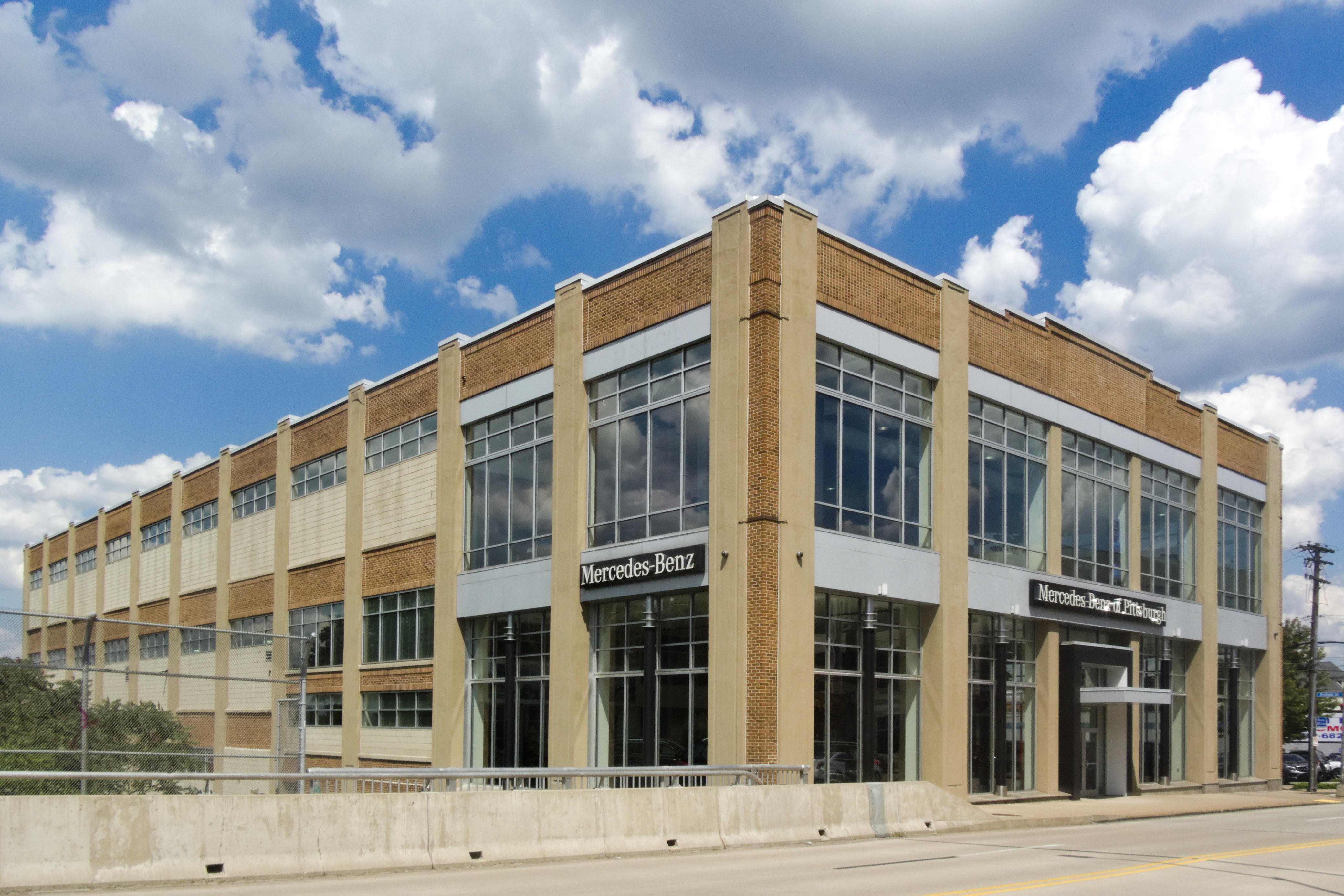
We continue our look at the remarkable number of early automobile dealers preserved in Oakland and Shadyside. This old Packard dealer on Baum Boulevard is still in the luxury-automobile business. Only the marque has changed; the building has been sensitively updated for our century, but in outline it is much the same as it was when Packards gleamed in its generously large showroom.
