Kosciusko Way, apparently named for the famous Polish hero of the Revolutionary War, is a narrow and crowded street that makes a brave attempt to go straight up from Josephine Street into the South Side Slopes, but makes it only a block before being utterly defeated by topography.
Edwards Way is the very edge of the South Side Flats. The greenery-covered wall on the left is the stone retaining wall below the railroad that separates the Flats from the Slopes. Of course this tiny narrow space is nevertheless too valuable to leave unbuilt, so the free side of the alley is lined with typical South Side alley houses.
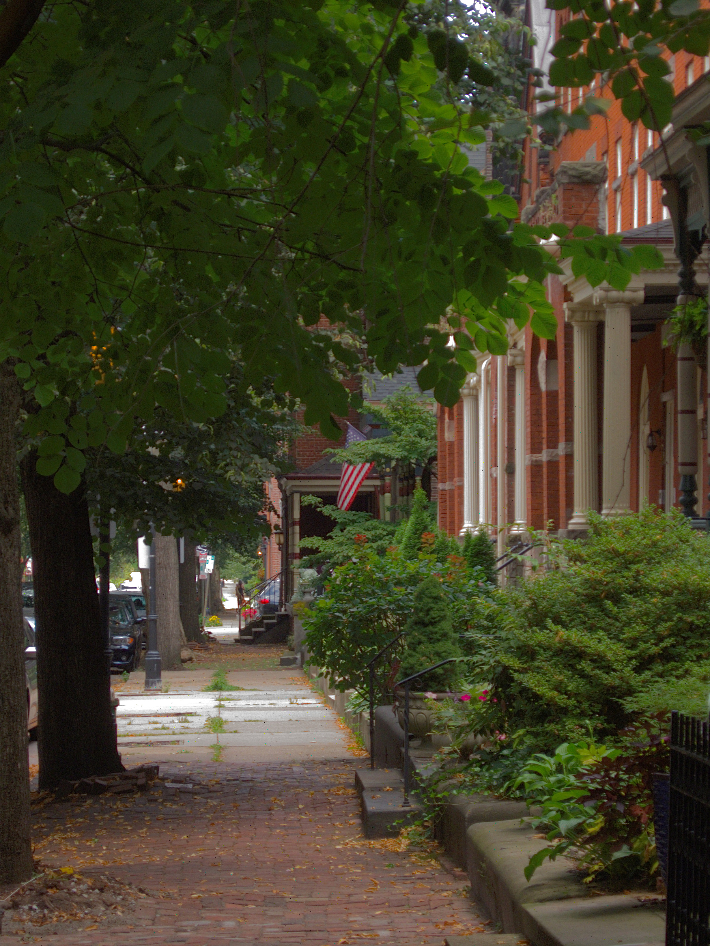
The last block of Jane Street on the South Side Flats (as opposed to the resumed Jane Street on the Slopes side of the tracks) feels delightfully private, lined on the north side with charming Second Empire rowhouses facing an old herringbone-pattern brick sidewalk. The colors of the houses and flowers shine out all the brighter in the gloom of a rainy day.
One of Pittsburgh’s distinctive features is the huge number of public stairways. Many streets that appear on maps are actually stairways, like Eleanor Street here. In the early days of GPS navigation, trip instructions would often send drivers up or down these streets; but most GPS systems have now learned to recognize the streets that can accommodate pedestrians only.
And bicycle cops. To be a Pittsburgh bicycle cop, you have to be able to ride down one of these stairways. If you are still alive at the bottom of it, you’re qualified.
Open Street Map does a good job of showing the public stairways on the South Side Slopes. All the denser red dotted lines are stairways. The narrower, sparser dotted lines are walkways.
Allegheny West is one of Pittsburgh’s most pleasant neighborhoods, and Beech Avenue may be the most delightful residential street in the whole city. The street is only two blocks long, but you would be hard pressed to find a better collection of domestic architecture on any street in the city. Add shady trees, a magnificent Gothic church at one end, and literary associations (Gertrude Stein was born here, and Mary Roberts Rinehart lived here when she wrote her most famous novel), and you can see why old Pa Pitt loves this street.
Some neighborhoods are so steep that the only way to build a street parallel to the slope is to do it in two parts. These two streets on the South Side Slopes are on the list of Pittsburgh History and Landmarks Foundation historic landmarks, but they are not the only terraced streets in the city. The same thing happens in Beechview, for example, another neighborhood laid out in defiance of topography. Above is Stella Street; below, Shelly Street.
It is utterly absurd that anyone would think of running a street up into this deep and narrow ravine cut into the South Side Slopes; but this is Pittsburgh, and we make absurd adaptations to an absurd topography. How long before those enthusiastic wild grapes swallow those helpless little frame houses?
Mission Street on the South Side Slopes looking westward toward St. Josaphat Church. The crowds of frame houses practically right against the street are typical of the neighborhood. By the standards of the Slopes, however, this is a luxuriously broad street.
A view of Sixth Avenue from the porch of the First Presbyterian Church, looking toward the Keenan Building with its fantastical dome. On the right in front of the Keenan Building are the Wood Street Galeries and Wood Street subway station.