
-
Gateway Station
-
A Broad View of Steel Plaza

An “ultra-wide” view of a Red Line car coming into Steel Plaza station, thanks to the five-megapixel “ultra-wide” auxiliary camera on Father Pitt’s phone.
Comments -
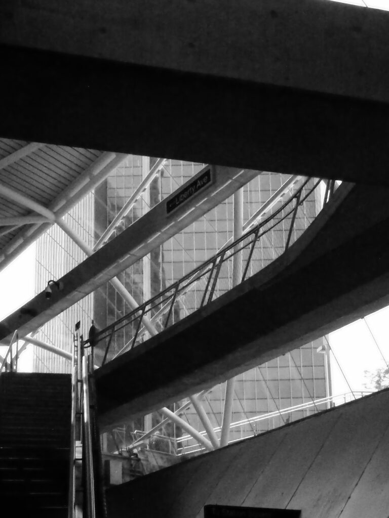
Entrance to the Steel Plaza Subway Station

Kodak EasyShare Max Z990. The Grant Street entrance to Steel Plaza station: a study in angles.
Comments -
The Blue Elephant

Fujifilm FinePix HS10. Very few people pay any attention to the Manor Building. It would be a large building except for the fact that it lives against a backdrop of much larger buildings, so its blackish bulk—which was originally blue—makes little impression in the postcard view of Pittsburgh from Mount Washington. But it has an interesting history.
The building was announced in 1955; the design was by Wyatt C. Hedrick of Fort Worth.1 The owner was the Pennsylvania Railroad, which was investing heavily in real estate. Executives noticed that Pennsy stations often sat on valuable land in expensive business districts. Why should all that value go to waste when you can build upward and profit from rentals? “Utilization of the air rights over railroad property where the property is strategically located in Downtown areas is becoming more prevalent,” the Press reporter noted when this building was announced.
That was what was going on here. For a long time the Pennsylvania had had a small commuter station here—the Fourth Avenue station. It was at the mouth of the tunnel that is now used by the subway. The station itself was a small building and a couple of platforms, but the land had become very valuable. So the plan was to build three floors of parking garage, and then ten floors of offices above the garage. There would still be a station in the basement. It should have been a profitable scheme.
From the beginning, however, there seemed to be a curse on the building. “It suffered one delay after another while being built,” said a Post-Gazette story in 1961.2 “Then, after finally being completed in 1958, it was tied up for a year by litigation involving the contractor.”
By the time it was ready for renters, the building was notorious. People called it the Blue Elephant—and nobody wanted to move in.
Not until 1961 did the building overcome its jinx and begin to fill up. After that it prospered. By the next year, it was completely filled.
So there you have the story of the Blue Elephant, and now that you have heard it, perhaps you will notice the building the next time you pass it on the Crosstown Boulevard or go under it on the subway. Then you will forget it again, because it does not make much of an impression on the skyline.
Comments -
Wilkinsburg Station

Designed by Walter H. Cookson, this station—one of the grandest of our suburban stations—was built in 1916. The last train left in 1975. After sitting abandoned for decades, the station has finally been restored to very nearly its original appearance.


The baggage area on the lower level.

Olympus E-20N; Nikon COOLPIX P100.
Comments -
East Busway at East Liberty Station

The busways in Pittsburgh are built mostly along old railroad right-of-way, and most of the stations are placed very near where the old commuter-rail stations stood. The Martin Luther King Jr. East Busway is unique in that the railroad still runs next to it; space for the busway came from the abandonment of extra parallel tracks on the busy Pennsylvania Railroad main line. Above, an outbound bus stops at the East Liberty station.

These views were taken from the Highland Avenue bridge across the railroad and busway. The bridge bears the Pennsylvania Railroad emblem in concrete.


Fujifilm FinePix HS10; Samsung Galaxy A15 5G. The use of the old railroad right-of-way, which runs in a series of hollows below the main street level of the neighborhoods it goes through, makes the East Busway a true rapid-transit line, as much grade-separated as a subway.
Comments -
University Line Stations Downtown

Yesterday we spoke of the busways as bus rapid transit done right. Here we see it done…the other way. The new University Line will be what counts as “bus rapid transit” in most other cities: there will be dedicated lanes for the buses most of the way, but they will have to deal with traffic lights and dozens of at-grade intersections to get from downtown to Oakland.

Fujifilm FinePix HS10. Nevertheless, this will be leagues better than what we have now to get from downtown to Oakland, which is stacks of buses tied up in rush-hour traffic. Instead of street corners with little signs sticking out of poles to mark them as bus stops, we’ll have these sharp-looking stations, which will provide some shelter from the rain and a few amenities like farecard vending machines and emergency telephones. (Can you get emergency cat videos on those emergency telephones?) Here are two of the nearly complete stations downtown: Market Square, which is a short block from the Diamond, and Wood Street, which is right across the street from the Wood Street subway station.
Addendum: A correspondent pointed out what we neglected to mention: that traffic lights at intersections will be synchronized to let buses pass through expeditiously. This is an important detail, and it is certainly true that it will make the system considerably swifter than it would be if the buses had to wait for the usual cycles. We reiterate that this will be much better than what we have now. Father Pitt would prefer a subway, but he doesn’t always get what he wants, and he is grateful for what he does get.
Comments -
Ingram Station on the West Busway

Like the Crafton station, the Ingram station on the West Busway is almost exactly where the old commuter-rail station used to be.

The busways in Pittsburgh are extraordinary accomplishments that we seldom appreciate. They are true metro lines for buses, making it possible for commuters to rocket through crowded urban neighborhoods at expressway speeds. Father Pitt always thinks rail transit would be better, but Pittsburgh stands out both as the inventor of “bus rapid transit” and as one of the few cities where “bus rapid transit” was done right.

Olympus E-20N; Canon PowerShot SX150 IS.
Comments -
Steel Plaza

Some pictures of Steel Plaza taken on a weekend when it was momentarily almost empty. The largest and most complex of our subway stations, Steel Plaza was built as a transfer station between the main line and a short spur to Penn Station—which, although it is not in regular service, is still kept up for special events and emergency detours. In the picture above, the Penn Station spur is in the foreground.

Here we see the two lines converging toward their junction in the tunnel beyond the station.


To add to the complexity, the station was designed to take the old PCC cars as well, which had only street-level doors. These lower-level platforms have been out of use since 1999, when the last PCC cars were retired, but the space isn’t useful for anything else, so the platforms are still there.

Comments -
Potomac Station


