Samsung Galaxy A15 5G with ultra-wide camera (so don‘t expect too much it you enlarge it)
Pittsburgh Railways, the streetcar conglomerate, had a big facility here in Glenwood (the southern end of what city planning maps mark as Hazelwood) with a car barn and this station and offices. The complex was adjacent to the Glenwood station on the B&O, where there was a large railroad yard with a roundhouse.
The building is now the Hazelwood Healthy Active Living Community Center, so it has been restored and is kept in exceptionally neat condition.
An “ultra-wide” view of a Red Line car coming into Steel Plaza station, thanks to the five-megapixel “ultra-wide” auxiliary camera on Father Pitt’s phone.
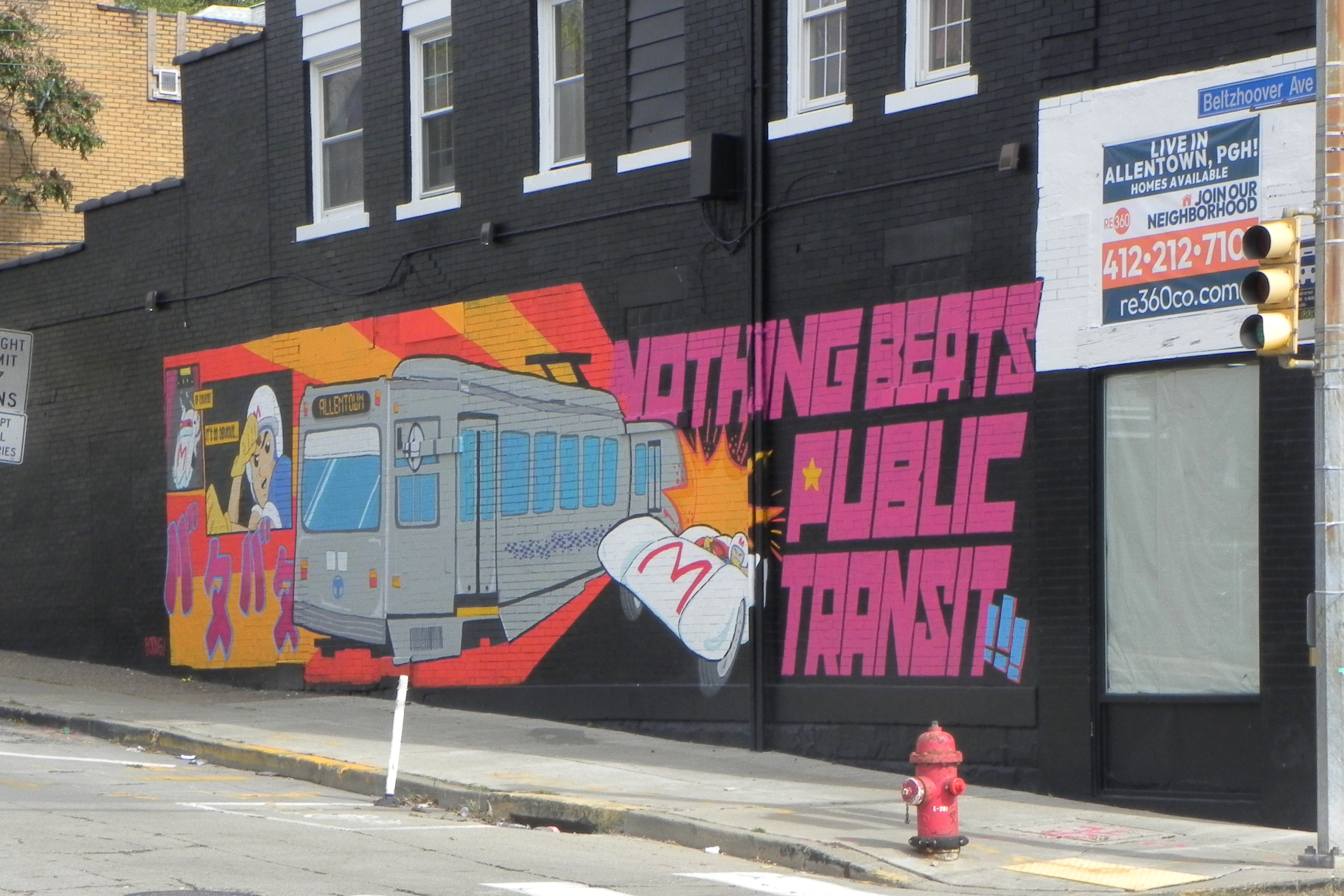
All summer long, all the rail routes have been detoured through Allentown. Stop and consider for a moment how thoroughly odd Pittsburgh transit is: do you know of any other subway system that keeps up an alternate route over the top for times when one of the tunnels has to be closed?
The few riders who look up from their phone screens have a chance to notice that Allentown is changing. Over the past few years, the Warrington Avenue business district has been going through a rapid trendification. It’s full of weird little shops too low-budget for the high rents of Lawrenceville.
“Transit-Oriented Development” is a favorite catch phrase among urban planners. In the early twentieth century, it was just the way development happened. Most people used streetcars to get to work, to shopping, and to all their amusements, so of course development and transit had to go together. Here we see a typical pattern: a main spine street—in this case, Broadway Avenue in Dormont—divided in two parts, with a broad median for trolleys. Many neighborhood main streets were built this way. Red Line trolleys still run here in Dormont, and Silver Line trolleys on a similar plan in Bethel Park.
Following the example of Montreal, Pittsburgh had each of its subway stations decorated by a different artist. The neon installation in Steel Plaza, called “River of Light,” is by Jane Haskell.
The style of the station itself combines Brutalism with Postmodernism.
Outbound car 4133 rounds the curve on Broadway, Beechview, in 1999, on route 42 (now the Red Line). The Siemens SD-400 car is in its original 1980s livery. It was later rebuilt as part of the 4200 series.
And that should be enough numbers to leave the trolley geeks drooling.
Back in 1968, the streetcar fan David Wilson from Oak Park, Illinois, USA, took this picture of a PCC car in front of the freight office for the Pittsburgh & Lake Erie Railroad. Except for looking cleaner, the building hasn’t changed much. Streetcars no longer pass in front of it, but they stop diagonally across the street at the Station Square station.
This odd little building in the middle of a gravel lot is a remnant of the largest streetcar system in the United States.
Arlington Avenue on March 30, 1968, with Route 48 streetcar coming out of the streetcar loop, by David Wilson from Oak Park, Illinois, USA, CC BY 2.0, via Wikimedia Commons.
We’ve already seen this picture of Arlington Avenue with the Route 48 streetcar poking its head out of the streetcar loop. That loop is still there, though the tracks have been taken up. You can see this little shelter right behind the trolley in the 1968 picture.
In the 1960s. Pittsburgh had the largest remaining streetcar system in the country. We had lagged behind other cities in converting to bus transit, but the Port Authority, newly responsible for the transit system, was canceling streetcar lines right and left. (Some lines have survived—the lines that had their own right-of-way for most of the route, and thus would have been expensive or impossible to convert to buses.) The Arlington line would not survive long after that picture; the Route 48 streetcar became the Route 48 bus.
Here the Route 48 bus passes a mural with a picture of its predecessor, the Route 48 streetcar. The “Arlington Memories” murals are fading and will soon be memories themselves. The Route 48 streetcar line used to make a loop around the shelter and head back inbound on Arlington Avenue.


.jpg)