The grand old name of Mellon is slowly disappearing from our landscape as BNY Mellon completes its rebranding to just BNY.
-
New Logo Going Up on the BNY Mellon Client Service Center

Fujifilm FinePix HS20EXR. -
Milo Street, Beechview

Like many other streets that appear on the maps of hilly neighborhoods, Milo Street is entirely stairs. Whenever you see a street sign that seems to be pointing off the edge of a cliff, a stairway like this is usually the explanation.


Kodak EasyShare Z1285. -
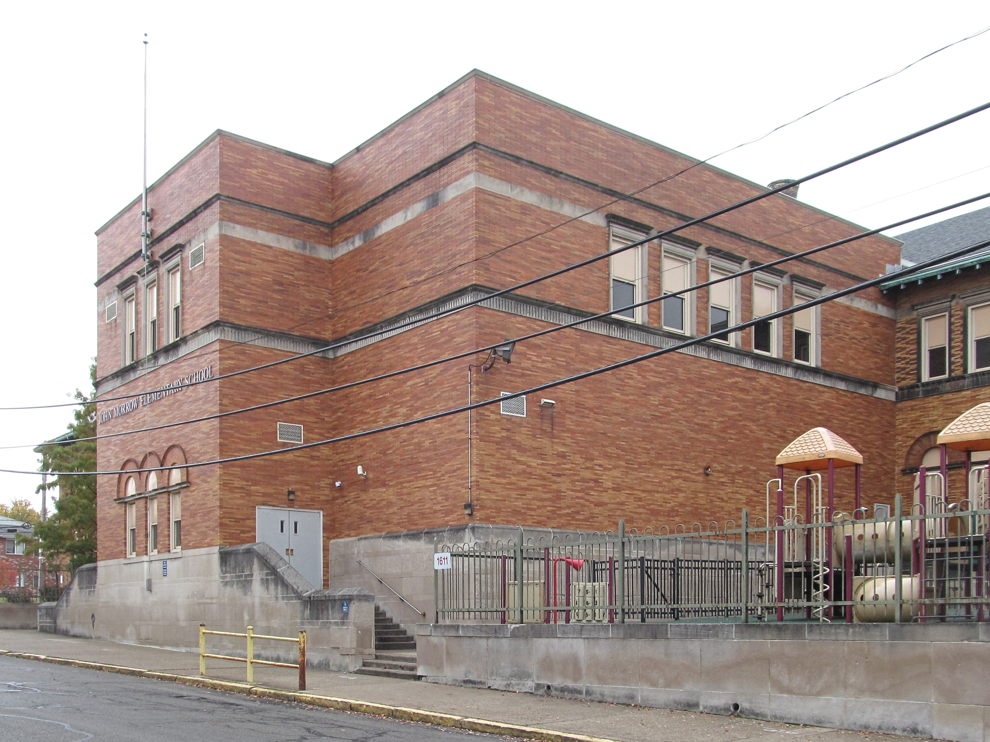
John Morrow Public School, Brighton Heights

The original school was designed by Samuel T. McClaren (or McClarren; we see it spelled both ways) in 1895. Over the decades it was encrusted with annexes and additions, until much of the original building was hidden behind later growths.

This is a small section of the original building peeking out between later additions. Note the tapestry brick on the second floor.

The care that went into designing and assembling this chimney ought to make us denizens of the twenty-first century ashamed of ourselves.

Annex No. 1 was built after 1903 but before 1910, obscuring the whole eastern side of the original building. This addition was probably also designed by McClaren, and matches the original very closely.
What is that little rectangular block of wood below the small central windows on the first floor?
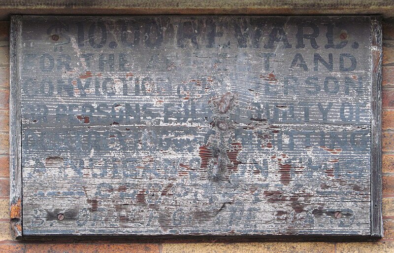
It’s a sign, probably almost as old as the building to judge by the style of the lettering, and with some effort we can read almost all of it:
$10.00 REWARD.
FOR THE ARREST AND
CONVICTION OF ANY PERSON
OR PERSONS FOUND GUILTY OF
DESTROYING OR COMMITTING
A NUISANCE ON THIS
PROPERTYOld Pa Pitt has not succeeded in deciphering the very last line, which probably tells us where to apply for our ten bucks.

In 1922, Annex No. 2 was built, obscuring the west side of the original building. Insofar as Pittsburgh topography allows, it is identical to Annex No. 1, but this time it is dated:

The difference in brickwork indicates that there were probably windows here originally.

What this town needs is more utility cables.

In 1958, the school got its last major addition, which covered most of the Davis Avenue front of the original building. By that time it was simply impossible to match the architecture of the original, but the architect made some attempt to echo it with similar Roman brick and three Rundbogenstil arched windows on the front. The brickwork here looks the same as the brick infilling of the windows in the annex above, which probably dates that work.
The school is still in use as Morrow Elementary School.
-
Concrete Street Signs

From the Engineering News for July 6, 1916. Father Pitt knows of no such signs remaining in the city, but he would be delighted to have any remnants pointed out to him.
Concrete Street Signs
The use of concrete as material for constructing streetname signs is novel at the present time, but it has proved practicable. Two such signs are shown in Fig. 9. These were designed and installed recently by the Department of Public Works of Pittsburgh. Both post and signboard are of granite-finished concrete. The design shown at the left is modified as a Lincoln Highway marker. The signplates are separate from the post, being so constructed that they swing about a vertical axis and may be clamped at any desired angle. The letters, of a black cement composition of permanent color, are about ⅜ in. thick and dovetailed securely into the concrete of the background.
-
Lafayette Hilltop Sign

This somewhat bedraggled sign is perhaps a little more emblematic of the neighborhood around it than it was intended to be. Lafayette Hilltop is not one of the ninety designated “neighborhoods” of Pittsburgh: it’s one of the many distinct subneighborhoods that have no official existence but a very real social existence. You’ll find it at the northern end of Federal Street where it crosses Lafayette Avenue—an area right on the line between “Perry South” (as the city planning maps call Perry Hilltop) and Fineview. It is a pleasant neighborhood with some fine houses and good residential streets, but also some decaying buildings and vacant landmarks. We hope the rising tide in the city will lift it into comfortably moderate prosperity.
-
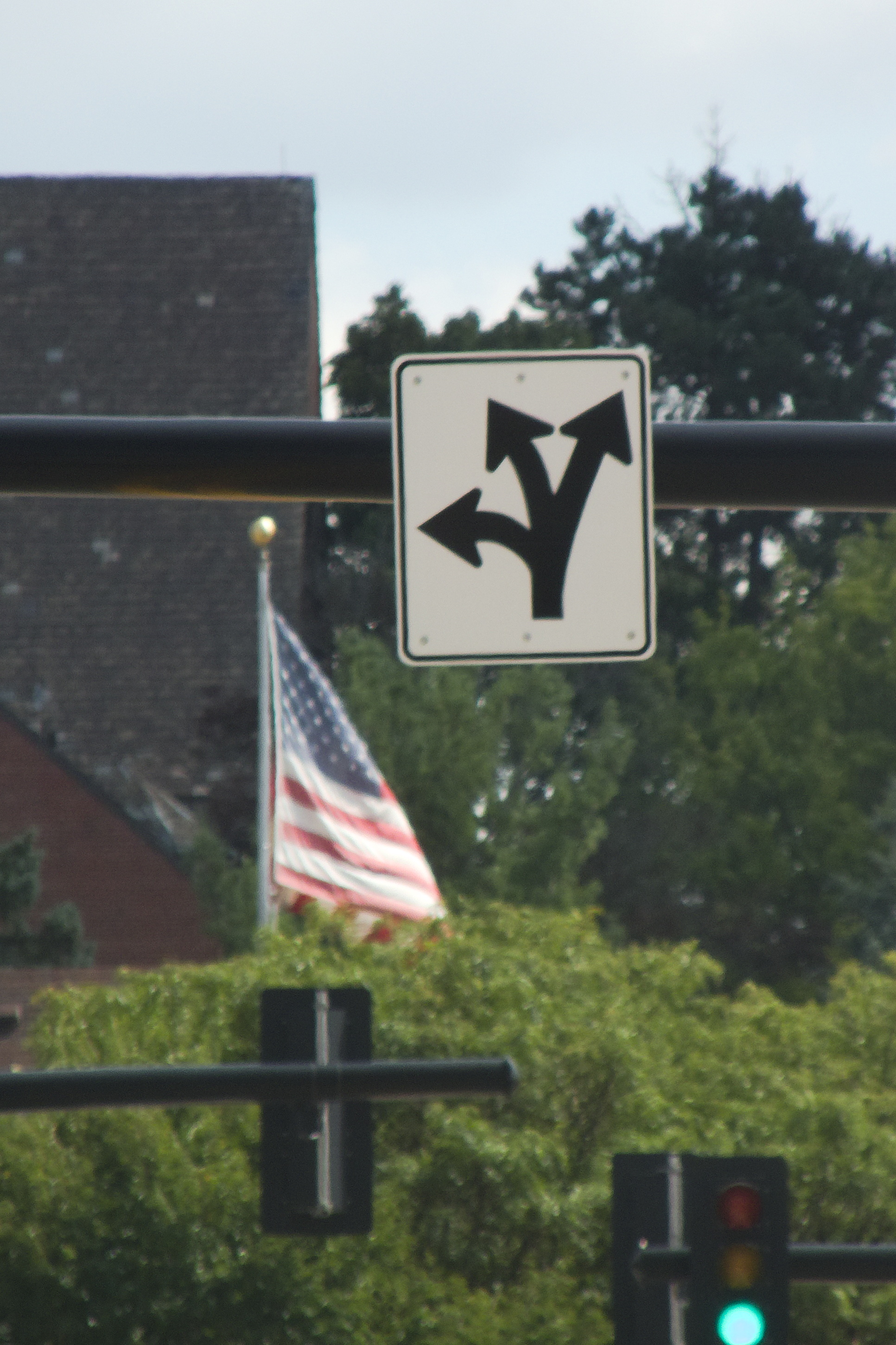
Go Straight at the Intersection

Or, you know, do your best. A typically Pittsburgh sign on Brookline Boulevard.
-
No Golf

It is a narrow trail along a precipitous wooded hillside, but Fox Chapel is still the kind of neighborhood where you have to specify “NO GOLF.” This is the south entrance to the Trillium Trail, which can be found on Hemlock Hollow Road, which used to bear the slightly embarrassing name of Squaw Run Road.
-
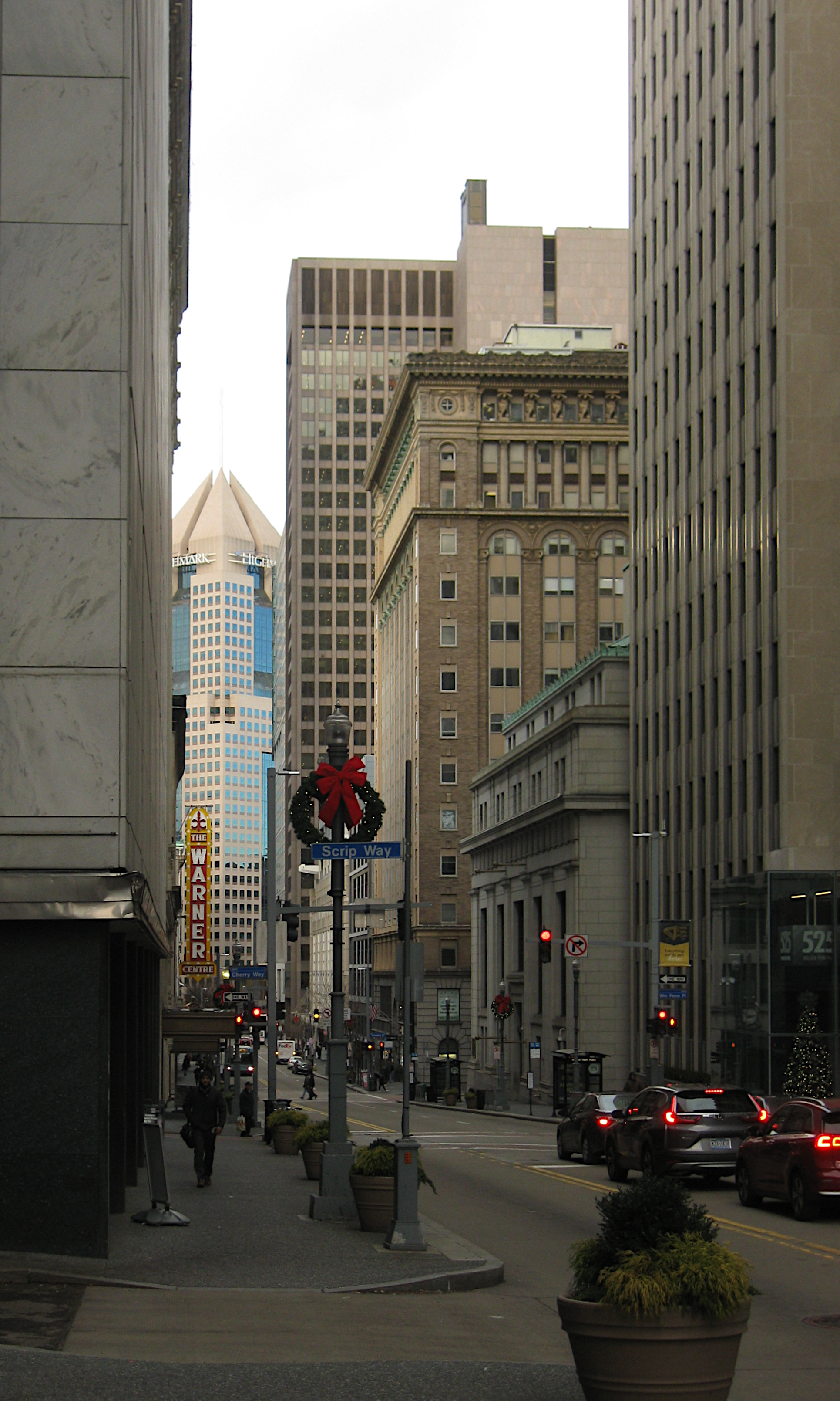
Warner Theatre Sign

The Warner was one of the great silent-movie palaces downtown, but it had the misfortune to be placed far from the theater district along Penn Avenue. In the 1980s most of it was demolished for a shopping arcade, leaving the classical façade on Fifth Avenue and the distinctive lighted sign, with the word “Theatre” replaced by “Centre,” because the shopping-arcade and movie-theater industries share an assumption that British spellings attract more customers. The shopping arcade, like most arcades downtown, gradually transitioned to mostly offices. But the sign still dominates the view down Fifth Avenue.