
Seen from a hilltop in Brookline. St. Basil’s is prominent on the skyline.
Seen from a hilltop in Brookline. St. Basil’s is prominent on the skyline.

Pittsburghers love to show out-of-town visitors the inclines, the dinosaurs at the Carnegie, the view from Mount Washington, the sandwiches with cole slaw and French fries piled inside, and other attractions of the big city. But often what the visitors talk about most is that they can’t believe how those houses cling to the side of a cliff. Here are some views of the South Side Slopes from the Bluff across the river, so that you can show out-of-town friends who have not yet visited that houses do indeed grow that way in Pittsburgh.
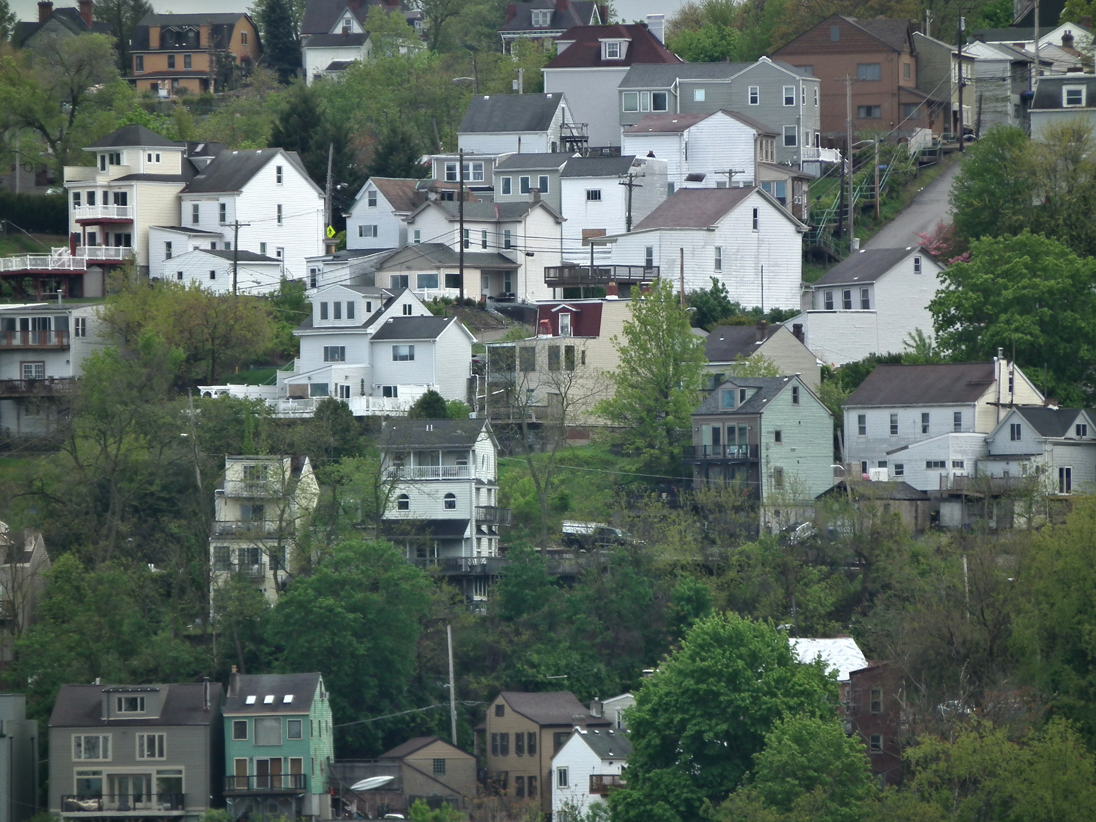

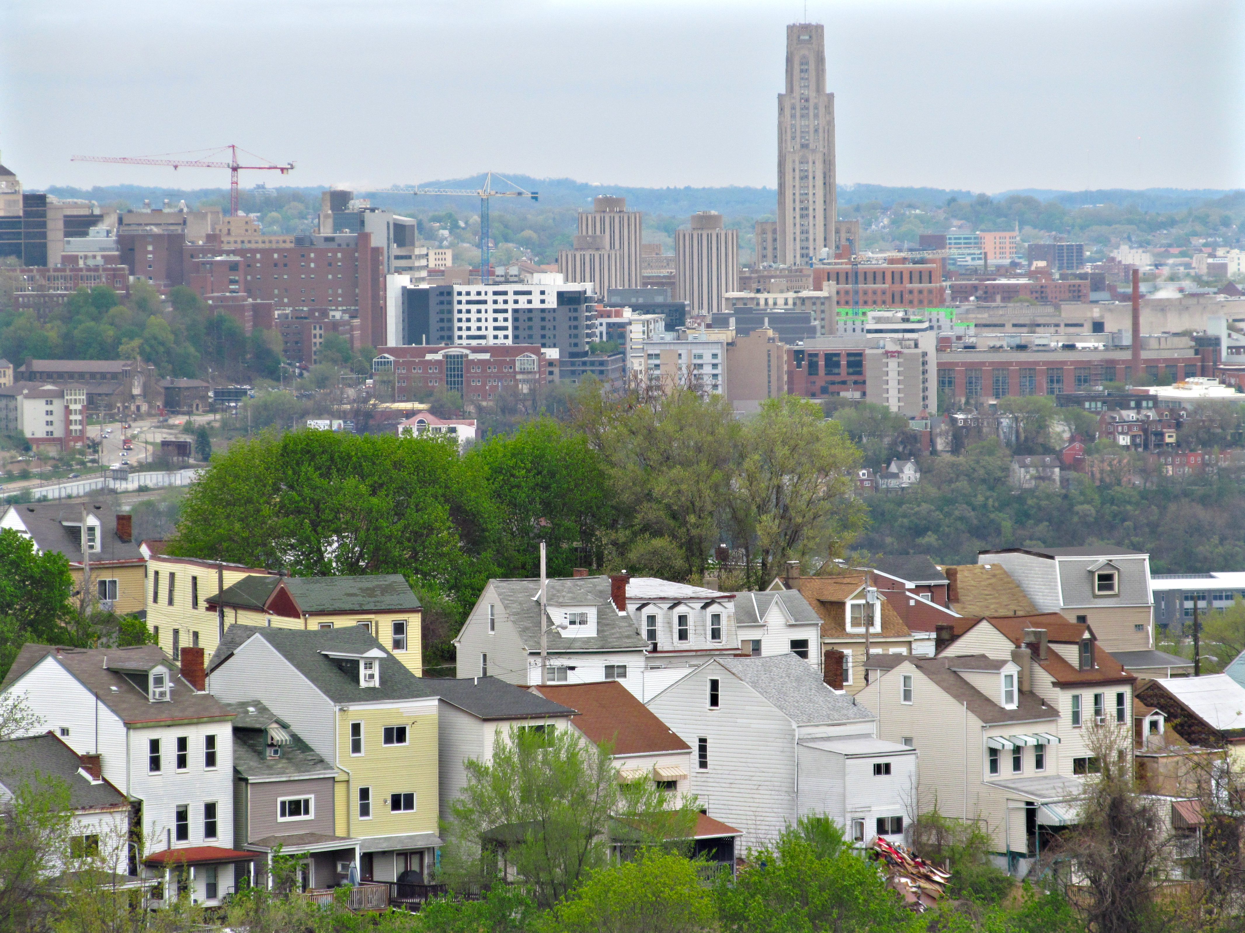
South 18th Street, which used to be the Brownsville Plank Road before it was taken into the city of Pittsburgh, snakes up through the South Side Slopes, following an ancient track that probably predates European settlement. It makes a long loop around a lumpy eminence known locally as Billy Buck Hill, where typical tall and narrow Slopes houses crowd on absurdly precipitous lots. These houses in the foreground are lined up along St. Paul Street. In the background, across the Mon, we see Oakland, which is as usual full of cranes.
The usual story of the etymology of Billy Buck Hill has to do with goats having been kept there, and that seems plausible. But old Pa Pitt is not willing to swear to it, because it has the look of one of those ex-post-facto etymologies suggested speculatively as the probable reason for the name, and then picked up as the only possible explanation and presented as fact.

Brereton Street was the commercial spine of Polish Hill. A few businesses still straggle along here, and the streetscape itself is one of those only-in-Pittsburgh sights: tall, narrow little buildings crowded on an improbably steep hillside, leading to a massive Renaissance church the size of a cathedral—Immaculate Heart of Mary.


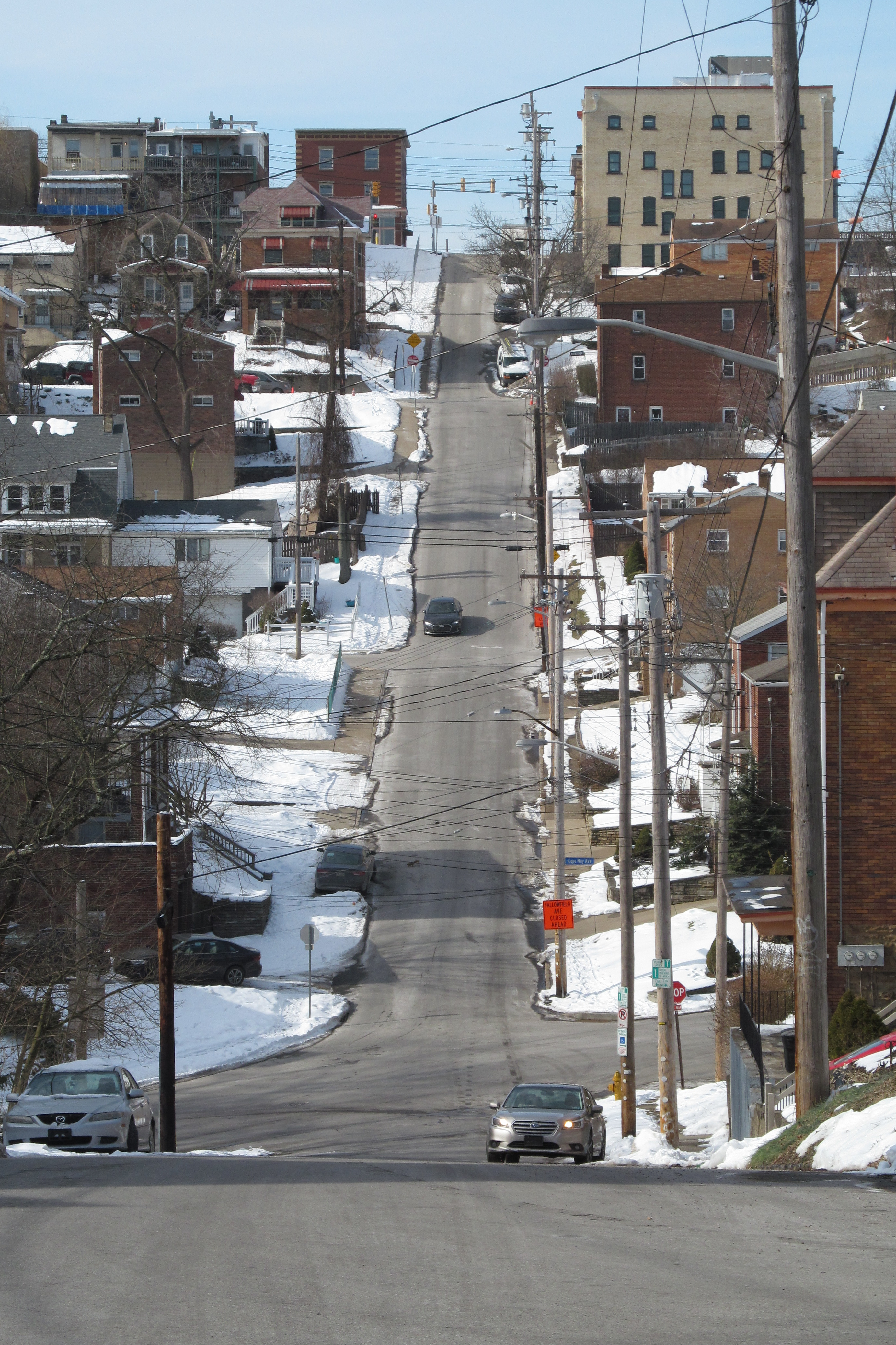
An out-of-towner might think that some horrible territorial war had happened to make Beechview residents throw a concrete wall right across the middle of Sebring Avenue. But the culprit is topography again. The streets in Beechview are laid out in a grid in defiance of the hills, and the only way to make Sebring Avenue intersect Westfield Street was with terracing.

We’ve seen terraces like these on the South Side Slopes, and here is a similar construction for a similar reason in Beechview. As you might guess from the parked cars, the street is two ways on both sides of the divide, which only adds to the delightful confusion. You can turn any which way from Sebring Avenue. The only thing you can’t do is continue on Sebring Avenue.


The Fallowfield viaduct is one of many engineering works necessary to get the Red Line as far as central Beechview. Its walkway is also a vital pedestrian link—vital enough that a few years ago, when the walkway was closed for repairs, the Port Authority gave free rides between Westfield and Fallowfield.
In addition to taking us from here to there, the walkway gives us interesting treetop-level views of the hilly back streets of this part of Beechview.

Father Pitt is convinced that the developers who laid out the streets in Beechview had never visited the site. Just draw lines north-south and east-west on a map, and you have your streets. Hills? Oh, they can’t be that bad, can they?
Here is Hampshire Avenue viewed from the Red Line streetcar crossing, with Broadway—where the Red Line crosses Hampshire again—at the top of the next hill.

Carrick dribbles down the precipitous slope from Brownsville Road. The church at upper left is St. Basil’s, now part of Holy Apostles Parish. The spire on the skyline right of center belongs to Zion Christian Church, built as Bethel Baptist Church.

Kosciusko Way, apparently named for the famous Polish hero of the Revolutionary War, is a narrow and crowded street that makes a brave attempt to go straight up from Josephine Street into the South Side Slopes, but makes it only a block before being utterly defeated by topography.

One of Pittsburgh’s distinctive features is the huge number of public stairways. Many streets that appear on maps are actually stairways, like Eleanor Street here. In the early days of GPS navigation, trip instructions would often send drivers up or down these streets; but most GPS systems have now learned to recognize the streets that can accommodate pedestrians only.
And bicycle cops. To be a Pittsburgh bicycle cop, you have to be able to ride down one of these stairways. If you are still alive at the bottom of it, you’re qualified.
Open Street Map does a good job of showing the public stairways on the South Side Slopes. All the denser red dotted lines are stairways. The narrower, sparser dotted lines are walkways.