Tag: Busways

  • East Busway at East Liberty Station

    East Busway at East Liberty station, with railroad

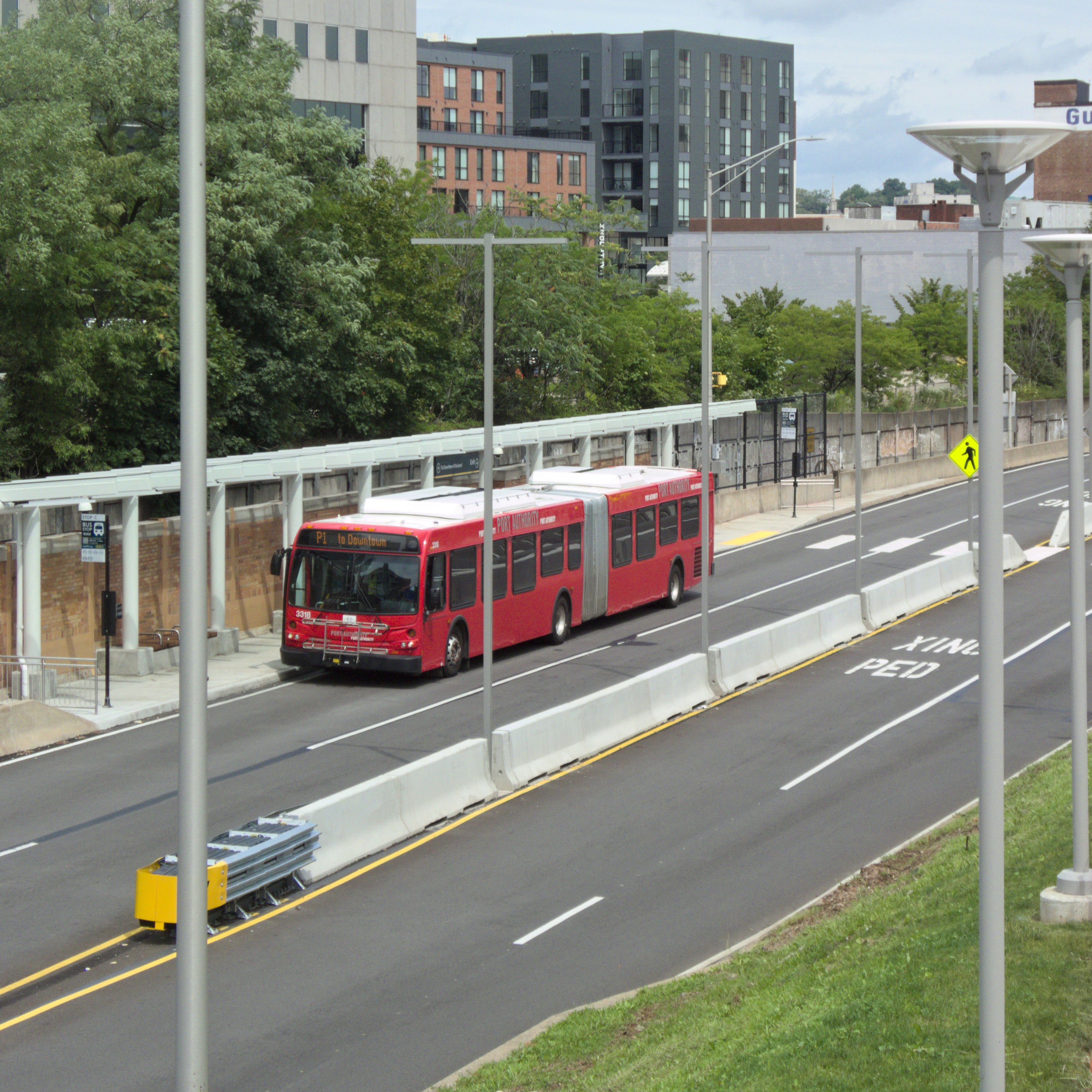
    The busways in Pittsburgh are built mostly along old railroad right-of-way, and most of the stations are placed very near where the old commuter-rail stations stood. The Martin Luther King Jr. East Busway is unique in that the railroad still runs next to it; space for the busway came from the abandonment of extra parallel tracks on the busy Pennsylvania Railroad main line. Above, an outbound bus stops at the East Liberty station.

    Pennsylvania Railroad emblem

    These views were taken from the Highland Avenue bridge across the railroad and busway. The bridge bears the Pennsylvania Railroad emblem in concrete.

    East Liberty station
    East Busway at Highland Avenue bridge
    Fujifilm FinePix HS10; Samsung Galaxy A15 5G.

    The use of the old railroad right-of-way, which runs in a series of hollows below the main street level of the neighborhoods it goes through, makes the East Busway a true rapid-transit line, as much grade-separated as a subway.


    Comments
  • Ingram Station on the West Busway

    Ingram station

    Like the Crafton station, the Ingram station on the West Busway is almost exactly where the old commuter-rail station used to be.

    West Busway from Ingram station

    The busways in Pittsburgh are extraordinary accomplishments that we seldom appreciate. They are true metro lines for buses, making it possible for commuters to rocket through crowded urban neighborhoods at expressway speeds. Father Pitt always thinks rail transit would be better, but Pittsburgh stands out both as the inventor of “bus rapid transit” and as one of the few cities where “bus rapid transit” was done right.

    Ingram station
    Olympus E-20N; Canon PowerShot SX150 IS.

    Comments
  • Crafton Station on the West Busway

    Crafton Station on the West Busway

    With St. Philip’s Church in the background.

    Most Pittsburghers probably don’t think of the busways as very interesting phenomena, so give old Pa Pitt a few moments of your time and he will try to make even a busway interesting.

    First of all, Pittsburgh is one of the very few cities that did “bus rapid transit” routes as real metro lines for buses. The three busways—South, East, and West—don’t mix with street traffic or even have at-grade intersections.

    Second, although the busways as busways are products of the late twentieth century, they all have roots much earlier. We started building the West Busway in 1851. It is a curious fact of our busways that they are almost one-to-one replacements for the old commuter-rail routes that started working in the middle 1800s. Even the stations are mostly in the same places; the Crafton busway station is just a few yards from where the railroad station used to be.

    Part of the West Busway is a subway tunnel between Sheraden and Ingram. Construction on the Cork Run Tunnel began in 1851; after many interruptions; it was finally finished in 1865.

    So if you ride the West Busway today, you are riding 174 years of history. Take time to think about that the next time you have to get somewhere, and you may conclude that even busways can be interesting as well as useful.

    West Busway crossing Crennell Avenue at the Crafton station
    The West Busway crossing Crennell Avenue at the Crafton station. Camera: Olympus E-20N.

    Comments
  • Penn Station

    Penn Station

    A Daniel Burnham masterpiece, fortunately preserved as luxury apartments (you have to go out back by the Dumpsters to catch a train). It was officially Union Station, but usually called Penn Station, since the railroads that were not owned by the Pennsylvania Railroad had their own separate stations.

    Union Station, Pittsburgh
    Penn Station
    Directly from the front
    Perspective view
    East Busway in front of Penn Station
    Fujifilm FinePix HS10.

    The East Busway runs right past the building on part of the original railroad right-of-way.

    We also have some close-up pictures of the terra-cotta decorations on Penn Station.

  • East Busway

    East Busway

    Other cities have King Boulevards; we have an East Busway that is officially named for Dr. King, but no one ever uses the whole official name, because by the time you have pronounced the decasyllabic name “Mar-tin Lu-ther King Ju-nior East Bus-way,” you have forgotten what you were talking about. Why not just “King Busway?” We do less honor to Dr. King by using his full name as the name of the busway, because no one ever speaks it.

    At any rate, here is the East Busway with two of its stations, in pictures that demonstrate why this busway is such a useful transit artery. Along with the railroad, it runs in a hollow that winds through Bloomfield and Shadyside, giving it the grade separation of a subway without the construction cost. It is in effect a rubber-tired metro line. Pittsburgh invented “bus rapid transit,” and for the most part we did it right.

    East Liberty station

    Above, East Liberty; below, Negley.

    Negley station