-
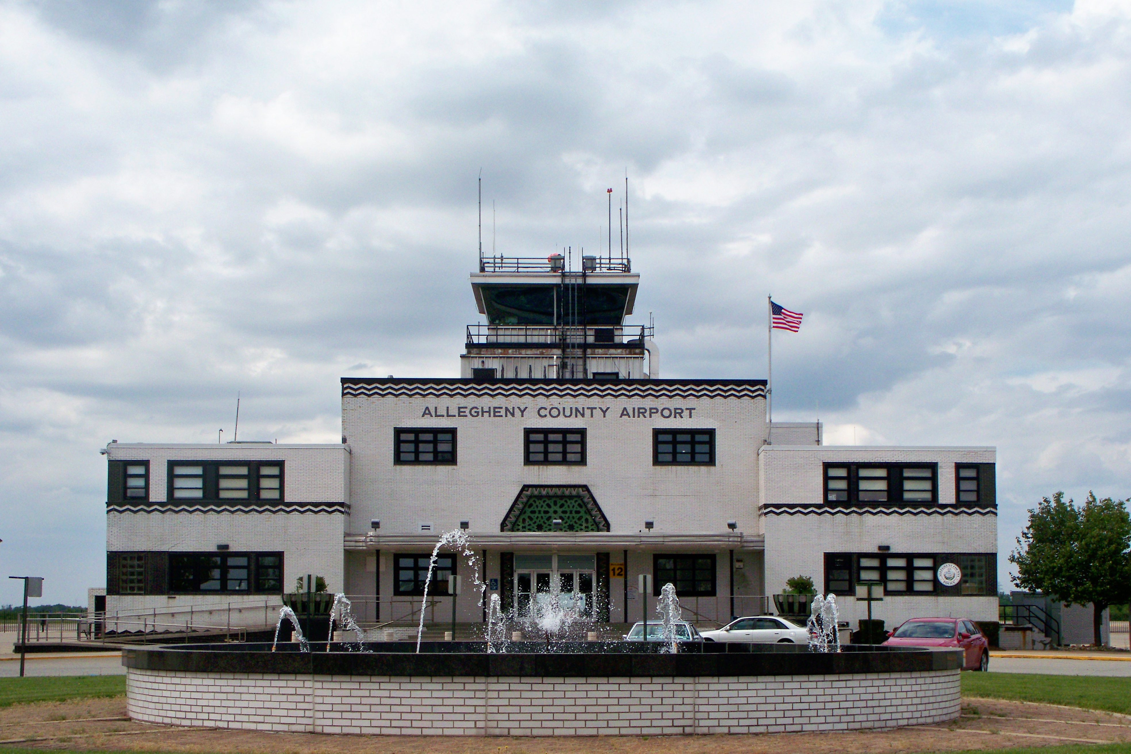
Allegheny County Airport

When this airport was built, it was the largest in the world in terms of runway footage; it is still one of the busiest airports in Pennsylvania, though there are no longer scheduled commercial flights. Moving the commercial flights to Greater Pitt meant that this airport never had to be rebuilt or modernized, so that the terminal (designed by Stanley L. Roush in 1931) is perhaps the most perfectly preserved Art Deco airport terminal in the world. It has played the airport in several period movies, and somewhere in a box or file Father Pitt has a picture of the terminal with the name “Bruxelles” replacing “Allegheny County Airport.”
Camera: Kodak EasyShare Z1485 IS.
-
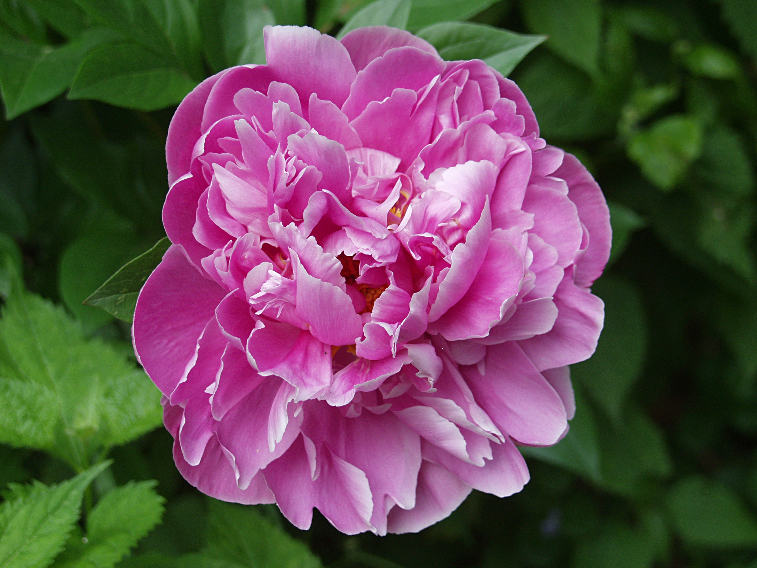
Remembering Those Who Served in the Civil War
The Civil War monument in Richland Cemetery, Dravosburg. The sculpture bears a maker’s plaque: “Manufactured by the W. H. Mullins Co., Salem, Ohio, U.S.A.”
Camera: Kodak EasyShare Z1485 IS.
-
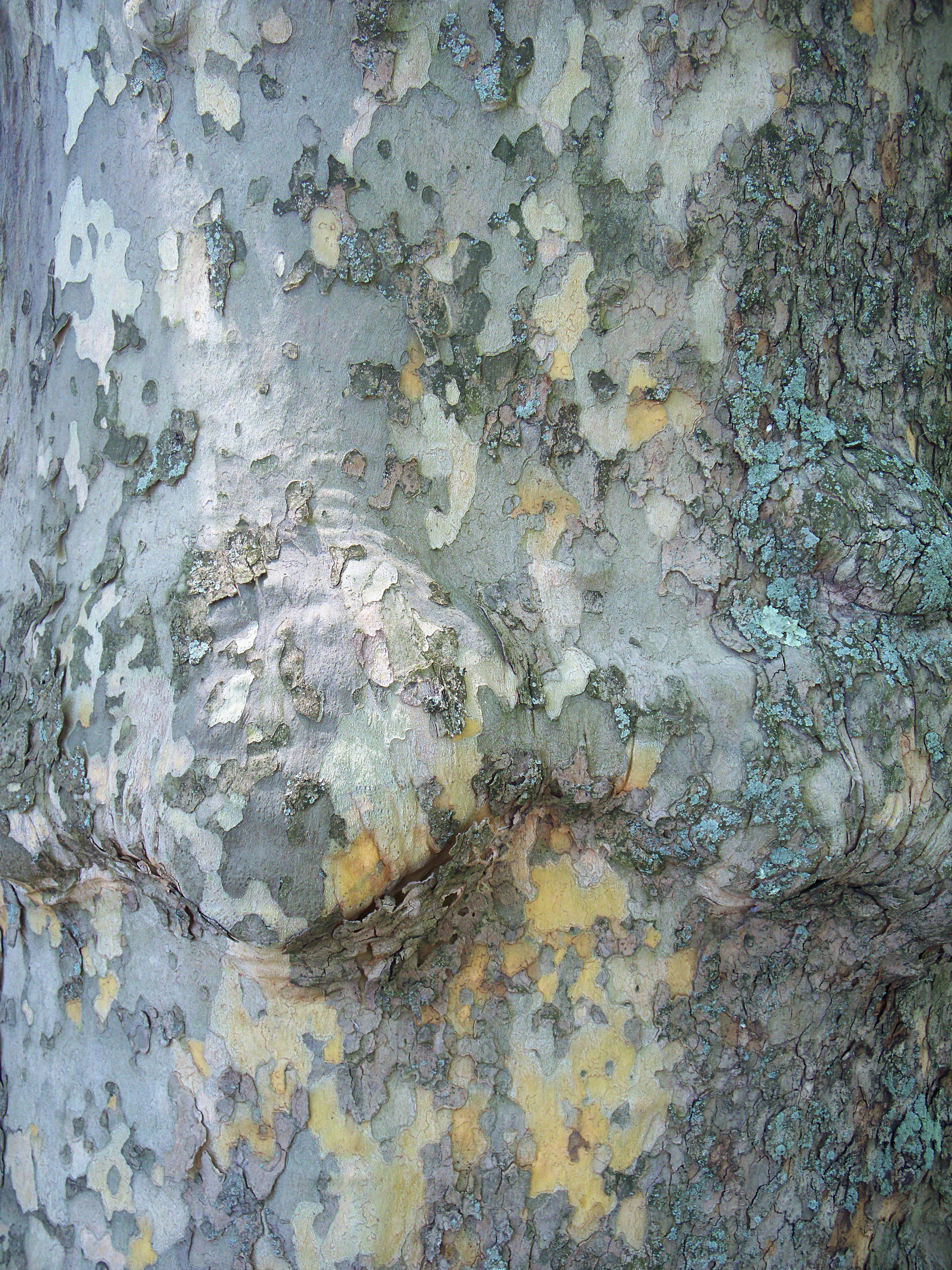
Sycamore Bark

The American Sycamore (Platanus occidentalis) is a splendid tree with a curious habit of shedding its bark in huge chunks. The result on a mature tree is often a very smooth surface mottled all over with decorative patterns. These trees are in the Smithfield East End Cemetery in Squirrel Hill.
Camera: Kodak EasyShare Z1485 IS.

-
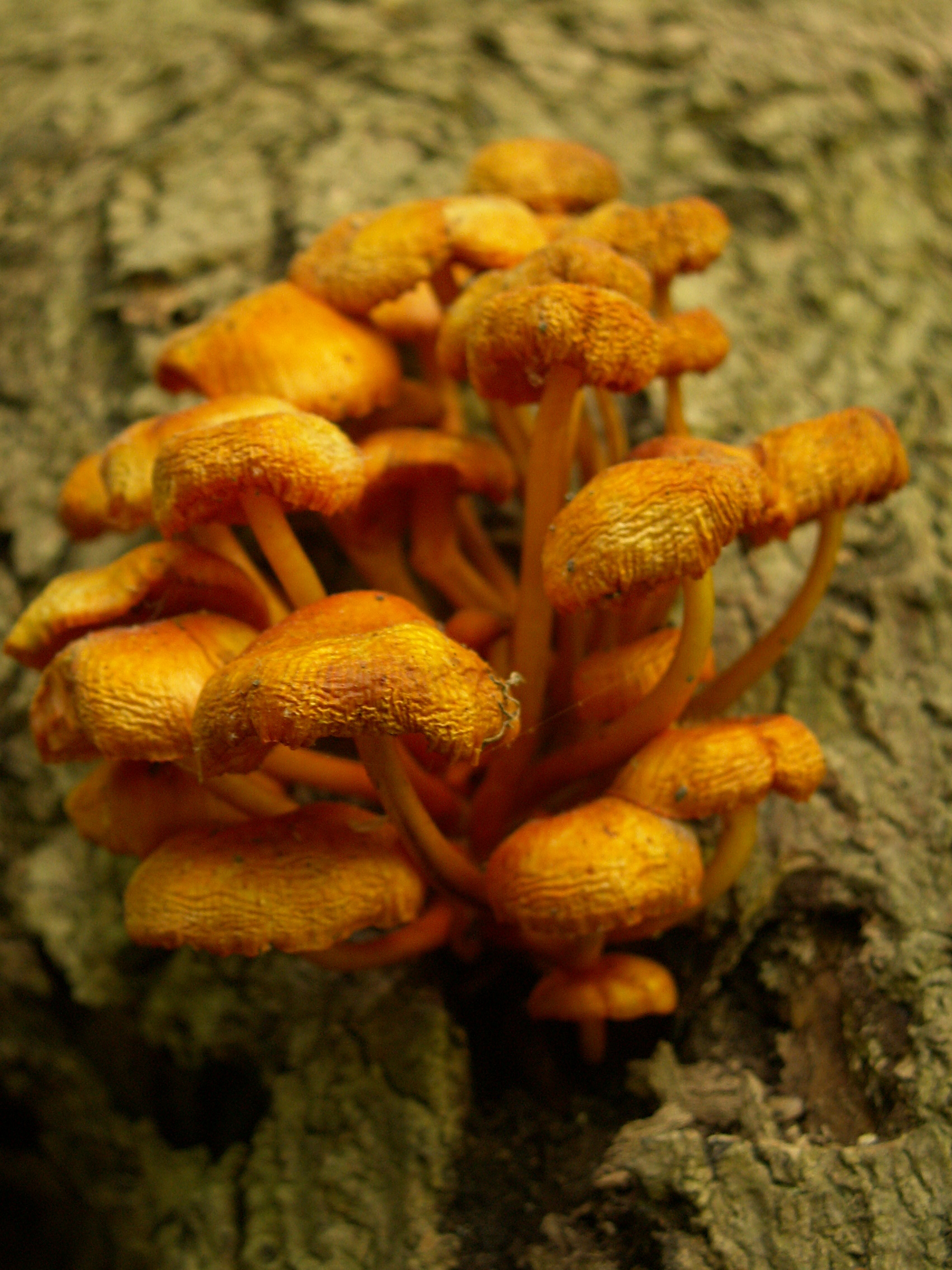
Orange Mushrooms
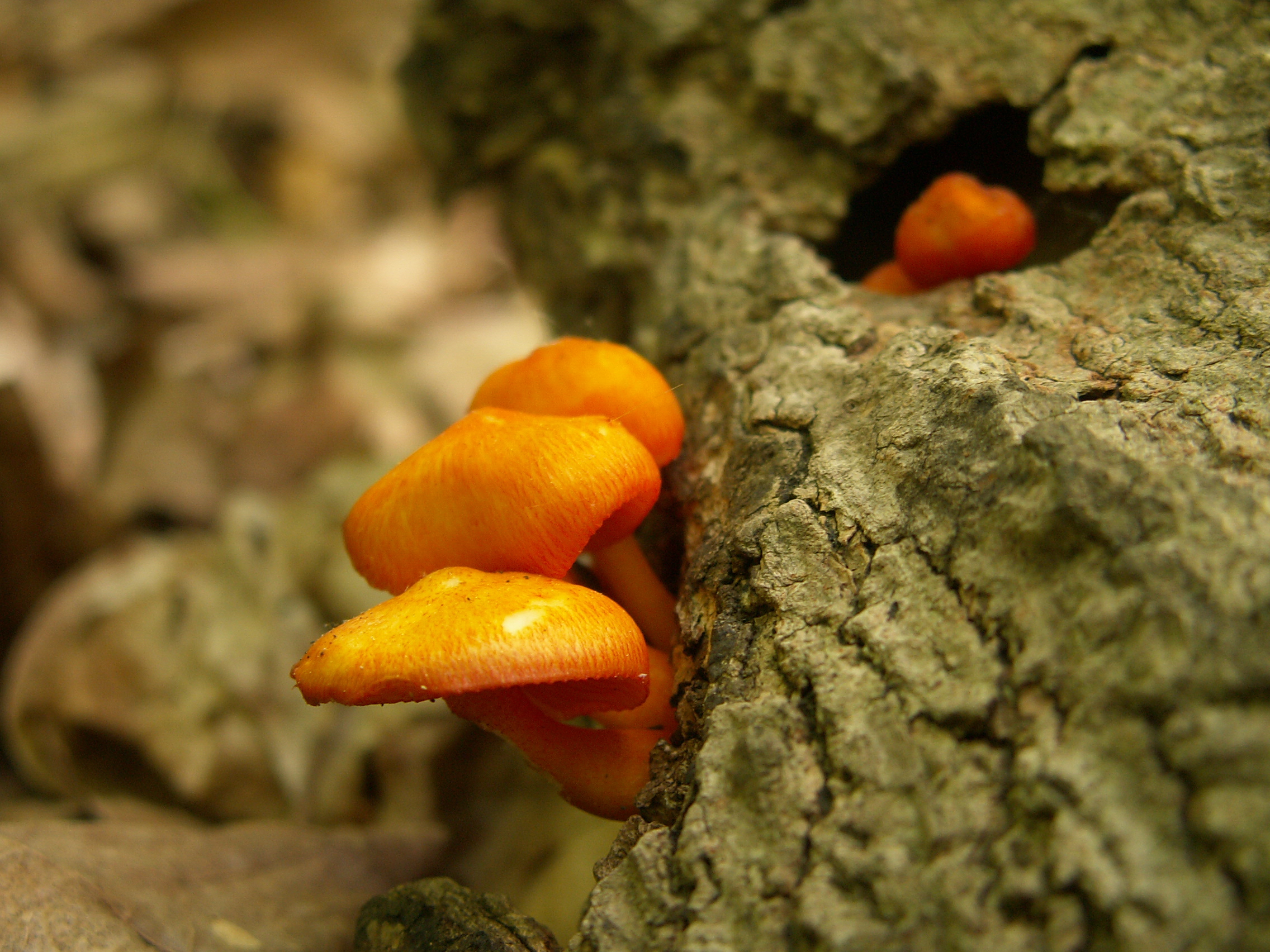
Old Pa Pitt is not a mushroom expert. He believes these to be Mycena leaiana, but any correspondent is invited to correct (or confirm) his identification. The ones below are a little past their prime, but still decorative.
Camera: Konica-Minolta DiMAGE Z3.
-
Visitor Center, Riverview Park

A very attractive little building put up in the 1940s, and doubtless influenced by the style of all the WPA work that had been done in local parks in the previous decade; here we see it in evening light, when the flowers for summer have just been planted.
Camera: Konica-Minolta DiMAGE Z3.
-
Design for the City-County Building

This rendering was published in 1916, before the building opened in 1917; but this is how the City-County Building still looks today. “Diamond Street” is now part of Forbes Avenue, except for the remnant of the outer end that veers off Forbes for one scraggly diagonal block to meet Fifth Avenue.
2 responses