The North Side station is our deepest underground station, and the only fully underground station outside downtown. It’s at the north end of the pair of tunnels that carry the subway under the Allegheny.
Compared to the older underground stations—Wood Street, Steel Plaza, and the old Gateway Center—this one is built on a grand scale, more reminiscent of the Metro in Washington than the rest of the subway in Pittsburgh. The decor is minimal, emphasizing the openness of the space.
The map displayed in subway stations, showing the extension of the line to Gateway, North Side, and Allegheny. Click on the picture for a very large version.
The new subway line to the North Side is rolling, and the stations are beautiful and functional. We begin with the wonderfully airy new Gateway station, which is flooded with natural light from the glassy superstructure above.
The mural “Pittsburgh Recollections” by Romare Bearden has been removed from the old Gateway Center station and reinstalled here at Gateway.
The old Gateway Center still survives as a ghost station; watch carefully for it between Wood Street and Gateway. Its name also survives in a curious way; it sounds as though the original recorded station announcement has been clumsily edited. As you come up on the new Gateway station, you hear a voice saying, “Approaching Gateway Ce—.” [UPDATE: This voice announcement has since been re-recorded without the ghostly sibilant.]
The Martin Luther King Jr. East Busway, which in the Pittsburgh Metro scheme almost but not quite adopted by the Port Authority would be the Purple Line, is an almost unique phenomenon in “bus rapid transit”: real rapid transit, but with buses. Unlike the half-baked busways in other cities, Pittsburgh’s busways are true metro lines, with no at-grade crossings or mixing with street traffic. Cheery signs like the one above were put up all over the neighborhoods the busway serves when it first opened in 1983; many of them are still there, though they do not seem to be maintained or replaced. Below, we see the real secret of this busway’s success: it follows the railroad through a deep hollow in the middle of the city, giving it a subway-like grade separation without the expense of digging tunnels.
Suburban riders on the Red Line, if they have ever lifted their eyes from their iPhones for a moment, must have noticed the peculiar anomaly of Beechview: a tidy and pleasant residential neighborhood with an almost abandoned business district. A good part of the abandonment was the result of a scandal-ridden failed urban-renewal project, in which the city gave millions to a private developer who vanished with most of the money.
But now the mess is nearly sorted out, and storefronts in Beechview are filling up with interesting and useful businesses.
The big accomplishment was finding someone to open a new supermarket, which will anchor the whole business district. The owner of the new Market on Broadway already has some experience operating a successful urban market in Oakland, the Market on Forbes.
—
A new neighborhood coffeehouse gives the locals a place to gather and gossip.
—
This 1920s-vintage storefront has been beautifully restored for the new Crested Duck Charcuterie, which will be an interesting addition to a neighborhood more accustomed to spaghetti and meatballs in a church basement.
—
A neighborhood artist has taken over this little building that was abandoned when the ESB Bank moved to larger quarters across the street.
—
Eventually, this clothing store will have a name other than “Grand Opening.”
—
All these new businesses face an uphill struggle; most new businesses fail, and Beechview residents themselves, who learned to go elsewhere for shopping, will have to be lured back to their own business district. But Beechview, aside from a strong sense of community, has one great strength most other neighborhoods lack: the Red Line, which brings rail transit right to the center of the business district. Perhaps some of those suburban riders will glance up from their iPhones, see the new Beechview, and start to think of it as a place for dining and shopping.We’ll see.
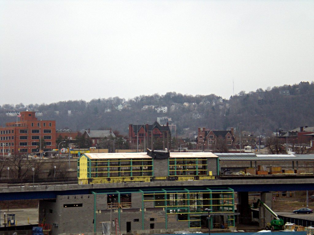
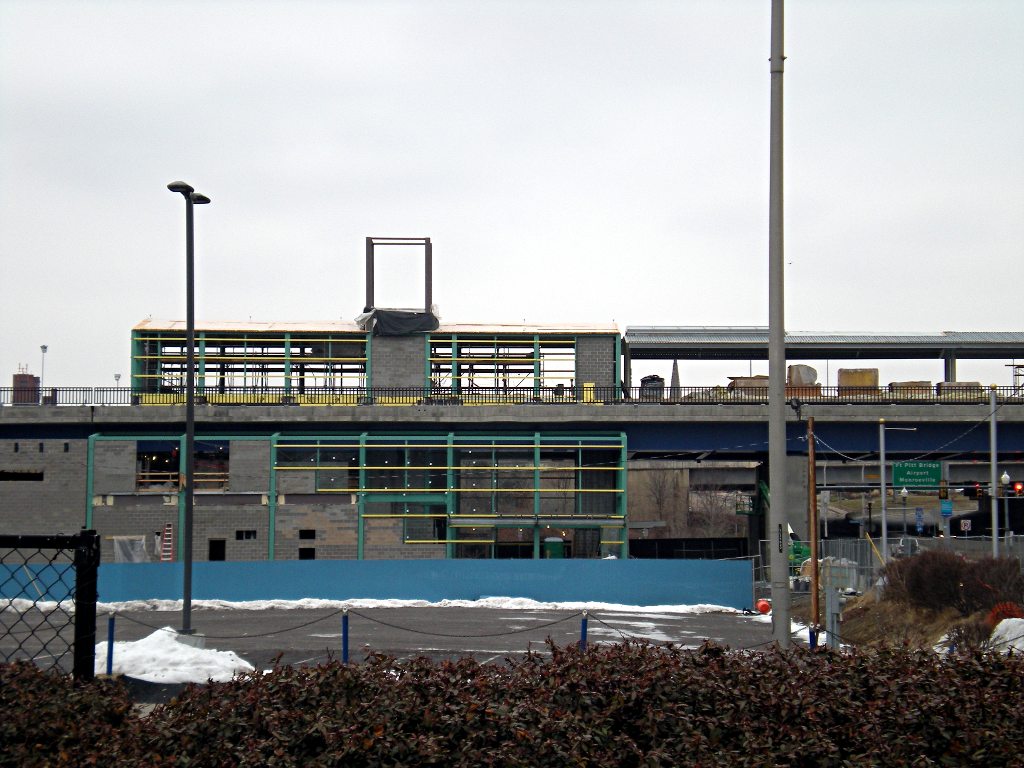
The new subway line (which in this section, obviously, will be an elevated line) to the North Side is taking shape. This will be the Allegheny station when it’s finished. The line is scheduled to open in about a year.
Update: This article is kept here for historical reasons, but the map here is out of date. For an up-to-date map, see Father Pitt’s latest article on Pittsburgh rapid transit.
—
Old Pa Pitt is amused. He finds endless fun in the workings of bureaucracy. The Port Authority is now operating under its new system of route names, and it’s perfectly obvious what happened.
Click on the image for a PDF map.
Can you spot it? Though Pa Pitt drew this map himself, he took the colors as well as the route names from the official Transit Development Plan map on the Port Authority’s site. It seems quite obvious to him that, at some point early in the revision, some genius hit on exactly the same idea that Father Pitt has been proposing for quite some time now: integrate all our forms of rapid transit (“fixed-guideway systems,” to use the language of bureaucrats) in a single system, with lines designated by colors, and you’ll have a first-rate Pittsburgh Metro.
Why are the routes that run on the East Busway designated by the letter P? Why do the ones on the South Busway begin with Y, and the West Busway with G? Obviously because the lines are purple, yellow, and green. But you won’t find that connection made anywhere on the Port Authority’s map.
Father Pitt would be happy to be corrected by someone who was privy to the actual decisions, but it seems obvious to him that the original proposal was just what he had suggested: include the busways in the system of colored rapid-transit lines. But somewhere along the way, some high-level bureaucrat lost his nerve. It would be too confusing to cal the Martin Luther King, Jr., East Busway the “Purple Line,” he thought. We’ll make it easier by calling it Routes P1 and P2, and we won’t mention the color purple anywhere just to keep from confusing people.
This is the way bureaucrats think, and Father Pitt would not be at all surprised to find that they had thought that way in this case.
Old Pa Pitt will admit to being a little baffled by the routes that use the Fifth Avenue bus lane in Oakland. They’re designated by R, and the line is dark red; but there’s another Red Line already. We haven’t quite run out of colors yet, you know. Orange is very popular in other urban transit systems.
The good news is that we’re halfway to common sense. The map already shows us what ought to be. Here’s a case where citizen activists can take over. We can simply start referring to the busways by their colors on the map. Call the West Busway the Green Line. It’s a green line on the map, isn’t it? Call the East Busway the Purple Line and the South Busway the Yellow Line. Sooner or later, the Port Authority will adopt what we have already made the de facto terminology.
A good transit link between downtown and Oakland would change Pittsburgh from a city with very good, even enviable, rapid transit to a leader in North American transit. It would certainly stimulate development along the route, and that would make some very good money for clever investors who see the opportunity clearly.
Here’s your chance to be one of those clever investors. Are a few hundred million dollars just burning a hole in your pocket? Why not give us the last essential link in our already enviable rapid-transit system?
Click on the image for a PDF map.
The Redevelopment Authority of Allegheny County has set up a Web site where interested parties can submit proposals. If you always fancied yourself a streetcar baron or a monorail mogul, here’s the opportunity you’ve been waiting for.
Two colliding grids make up downtown Pittsburgh’s street layout, and the collision happens at Liberty Avenue, giving us a fine array of odd-shaped buildings. This triangular structure, built as a bank, now houses the Wood Street subway station below and the Wood Street Galleries, an important contemporary art gallery, on the upper floors.
This picture was taken with a Kiev-4 camera, a Ukrainian rangefinder that Father Pitt loves with an unreasoning passion. He would like to state for the record that the hideously rusted car in the foreground is not his fault.
Late-afternoon sun catches a Route 42C train headed inbound across Dagmar Avenue on the Fallowfield Viaduct in Beechview. In rush hour, two-car trains run on all routes except 52. Route 42C will soon be the Red Line, according to the Transit Development Plan


