UPDATE: Another more intact copy of the map has surfaced; see below.
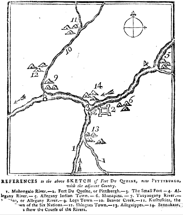
Old Pa Pitt is very pleased to be able to present to you what must be one of the very earliest printed maps of Pittsburgh, perhaps the very earliest, printed only a month or so after the British founded the place on the ruins of Fort Duquesne. It can be found on the last page of the London Magazine: or, Gentleman’s Monthly Intelligencer, for January of 1759. Unfortunately a bit of the page is torn, but the missing words do not affect the meaning very much. (The last line almost certainly reads, “The Arrows shew the Course of the Rivers.”) All friends of civilization owe a great debt of gratitude to the Google Books project for making possible research that would have taken decades of work and thousands of miles of travel in the old days of, say, ten years ago.
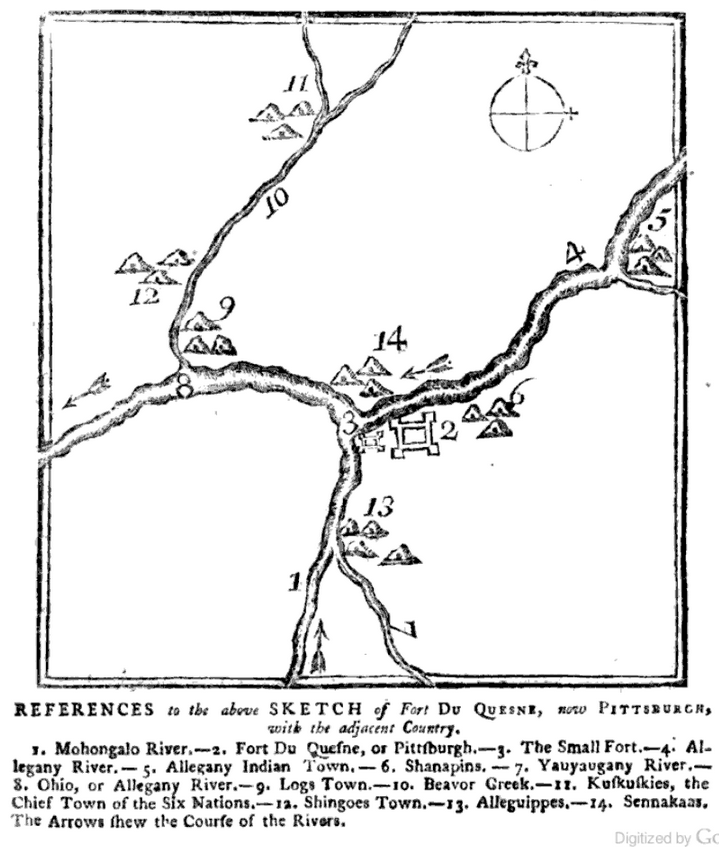
——Father Pitt has found another copy of the same magazine in which the page is not torn. Here is the same map intact:
Leave a Reply